Dipsea, Steep Ravine and Matt Davis Trail Loop

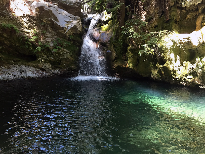
A good friend of ours is moving back to the East Coast this week. She wanted to spend one of her last few weekends in California seeing some sights. It’s a long drive to Stinson Beach (from almost anywhere), but this hike was a great choice. It has redwoods, waterfalls and ocean views. All very California. Continue reading “Dipsea, Steep Ravine and Matt Davis Trail Loop”

Hiking the Lost Coast Trail

The Lost Coast is the most rugged, undeveloped stretch of coastline in California. There are no highways or major roads in the area.  It was named the “Lost Coast” after the region experienced depopulation in the 1930’s, but the name still seems appropriate today considering the isolated nature of the place. Continue reading “Hiking the Lost Coast Trail”

Hiking the West Coast Trail

For Rob’s birthday (and his one and only week off between school semesters) we wanted to do something kind of epic.  After tossing around a few different vacation ideas, we settled on hiking the West Coast Trail – a 75 km trek along Vancouver Island’s beautiful coastline.  We spent 6 nights and 7 days on the trail.  The following is a description of our experience.  (Planning to hike this?  Visit our West Coast Trail overview page for more info!) Continue reading “Hiking the West Coast Trail”

Point Reyes – Mount Wittenberg, Glen Camp & Arch Rock

00

Point Reyes National Seashore offers a vast network of hiking trails, four backcounty campgrounds, and plenty of opportunity to get outside.  It’s possible to bike, ride a horse, trail run, or kayak all around this area.   On this particular trip, we hiked to the highest point in the area (not worth it), camped at one of the four backcountry campgrounds, and visited the very popular Arch Rock.  We hiked approximately 16 miles (9 miles on Day 1 and 7 miles on Day 2).  We spent most of the weekend in dense forest – no sweeping ocean views.  It was not what I expected but it turned out to be a relaxing weekend with beautiful scenery. Continue reading “Point Reyes – Mount Wittenberg, Glen Camp & Arch Rock”

Mt Tamalpais via the Steep Ravine Trail

If you wanted to, you could drive almost to the top of Mt. Tamalpias. But if you want to really climb Mt. Tam, then start from the ocean. This hike leaves from Stinson Beach and climbs the Steep Ravine trail up to East Peak, then loops back on the north side. The grand total is over 16 miles, and a few thousand feet of elevation gain.

00

Basics:  This hike climbs from Stinson Beach to the East Peak of Mt Tamalpais.  It’s a long one – we hiked it as a loop totaling over 16 miles round trip.  We reached the top via the Steep Ravine Trail, Matt Davis Trail and Old Railroad Grade road.  We returned on the International Trail, Northside Trail, Bay Area Ridge Trail and Matt Davis Trail (among others).  Mt Tam has an amazingly large and well developed network of trails and roads.  There are many options.  Everything is well-signed, but unless you know where you are going, bring a map! Continue reading “Mt Tamalpais via the Steep Ravine Trail”

Garrapata State Park Loop

01

Basics: This 4+ mile loop trail in Garrapata SP goes from coastal chaparral to grassy hills with epic views to dense redwood forest.  Parts of the trail are really steep, but the ocean views and springtime wildflowers are enough to keep anyone going.  We added a side trip to Doud Peak, making this a 6 or 7 mile hike.  Doud Peak was not worth the extra effort, but more on that later.  This hike would be nice any time of year, but it’s especially pretty in the spring when the plants are still somewhat green and the wildflowers are blooming.  It’s also a great workout if you are in the area and want to hike something that won’t take all day. Continue reading “Garrapata State Park Loop”

Channel Islands – Santa Cruz Island Backcountry

Basics: This trip is an easy beginners backpacking trip on Santa Cruz Island at Channel Islands NP. The trickiest part is getting a campsite reservation, arranging transportation to and from the island, and packing in your water. This hike could be anywhere from 7 to 20+ miles round trip, depending on where you get off the boat. We hiked 3.5 miles to the backcountry campsite, and took a longer 5 mile route back out. Continue reading “Channel Islands – Santa Cruz Island Backcountry”