
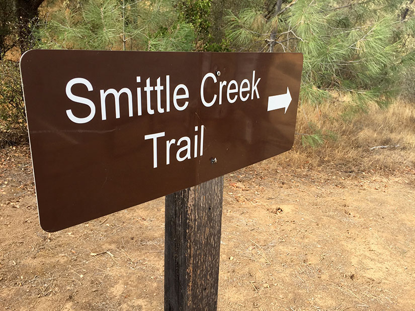
Smittle Creek might be the least exciting hike we’ve gone on this year. I think it has the potential to be really nice – if Lake Berryessa had more water in it and if the hills were green, things would look very different. Nevertheless, with Stebbins Cold Canyon still closed to the public after the Wragg Fire, we’ve been driving a little further to find new trails. Despite the somewhat drab landscape, I actually really enjoyed this trip. The soft dirt trail is perfect for running. We also found it to be incredibly quiet and peaceful: very few people visit Lake Berryessa this time of year. Continue reading “Smittle Creek Trail”
Category: Napa County
Annie’s Trail
Annie’s trail is a loop that was added to the existing Cold Canyon trail in 2012. Together, the two trails make for a 7.5 mile hike with about 2500 ft elevation gain – a moderately strenuous hike.
Basics: We started the new year off right with a hike along Blue Ridge near Cold Canyon. Annie’s trail is a loop that was added to the existing Cold Canyon trail in 2012. Together, the two trails make for a 7.5 mile, moderately strenuous hike. A highlight of Annie’s Trail is Annie’s Rock – a giant boulder outcropping near the top of the ridge. It’s a great spot for lunch.
The trail is still relatively new – in 2009, Tuleyome and supporters purchased Cold Canyon Headwaters, a 72-acre parcel in the upper watershed above Stebbins Cold Canyon UC Natural Reserve. Tuleyome volunteers built the 2.5 mile loop and named it Annie’s Trail. It is named after late Tuleyome board member Anne Schneider who was instrumental in helping preserve the Cold Canyon Headwaters. Continue reading “Annie’s Trail”
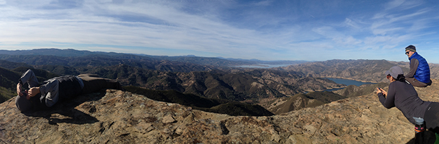
Blue Ridge – Fiske Peak Loop Trail

Basics: This 17+ mile loop on BLM land travels along Blue Ridge, then descends and winds through Fiske Creek’s riparian canyon. This trail would be difficult on a hot summer day, but it is a great winter hike with expansive views. Continue reading “Blue Ridge – Fiske Peak Loop Trail”
Mount Saint Helena
This is a hike to the highest peak (4339 ft) in Sonoma County, though it’s only about 1500 ft or so away from the Napa County line. The hike is 10.2 miles roundtrip, with an elevation gain for around 2300 ft.

In honor of Robert Louis Stevenson’s 160th birthday today, we are proud to present the first post ever on our blog. This trail is located in Stevenson’s own California State Park, where he lived in a cabin and wrote The Silverado Squatters.
Summary: This is a hike to the highest peak (4339 ft) in Sonoma County, though it’s only about 1500 ft or so away from the Napa County line. This trail follows a gently graded fire road, so in cool weather it’s fairly easy despite the distance. The hike is 10.2 miles roundtrip, with an elevation gain for around 2300 ft. Parking is free on the side of the road.