
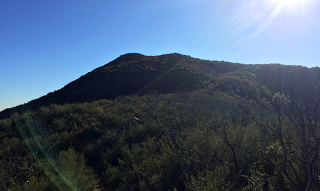
This is probably one of, if not the most difficult day hike in the Bay Area. Reaching all four of Diablo’s summits requires a full day – it’s 15 strenuous miles with over 6000-ft of elevation gain. We knocked this out in 8 hours. And yes, my legs hurt the next day. Continue reading “Mount Diablo’s Four Summits”
Tag: oak woodland
Smittle Creek Trail
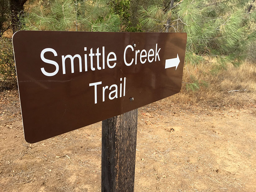
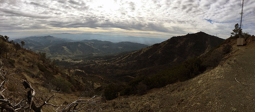
Smittle Creek might be the least exciting hike we’ve gone on this year. I think it has the potential to be really nice – if Lake Berryessa had more water in it and if the hills were green, things would look very different. Nevertheless, with Stebbins Cold Canyon still closed to the public after the Wragg Fire, we’ve been driving a little further to find new trails. Despite the somewhat drab landscape, I actually really enjoyed this trip. The soft dirt trail is perfect for running. We also found it to be incredibly quiet and peaceful: very few people visit Lake Berryessa this time of year. Continue reading “Smittle Creek Trail”
Pico Blanco
Pico Blanco. It’s a mountain. It’s a backcountry camp in Big Sur. And it’s a Boy Scout retreat in the Ventana Wilderness. We visited all three in two days and twenty miles. Continue reading “Pico Blanco”
Pleasants Ridge – Putah Creek Wildlife Area
Pleasants Ridge is one of those trails I’ve passed by and ignored on many occasions. We are frequent visitors to the Stebbins Cold Canyon Loop, but we rarely branch out to any of the other trails in the area. The Pleasants Ridge hike starts at the same trailhead – just off of Highway 128 in the Putah Creek Wildlife Area. Roundtrip distance is about 2 or 3 miles, depending on how far you want to go. We followed the trail to the end of the ridge. The last half mile or so is very overgrown and does not see a lot of visitors. Continue reading “Pleasants Ridge – Putah Creek Wildlife Area”
New Year’s Day Hike: Fiske Peak
It’s becoming our annual tradition to hike on New Year’s Day. Spending time in the outdoors is a great way to start off a new year. (Though really, when is it not a great time to get outside and hike?) Continue reading “New Year’s Day Hike: Fiske Peak”
Briones Regional Park
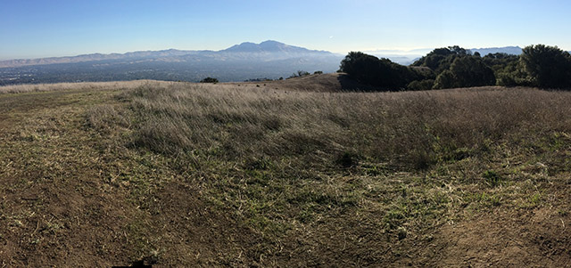
If you’re looking for a wild and rugged place to hike, Briones Regional Park is not it (unless you consider cows to be “wildlife”). The park does offer a substantial network of trails within the heart of Contra Costa County. Rolling grassy hills provide spectacular views of Mount Diablo, the Carquinez Strait and the surrounding suburbs. Briones is one of the many parks managed by the East Bay Regional Park District. At 6000+ acres, it’s easy to hike or run 10+ miles if you’re looking for a challenge. The trails which are mostly wide fire roads, are both dog friendly and mountain bike friendly. We walked a 6-mile loop through oak woodland, to the top of Briones Peak and back down over rolling, sometimes steep terrain. Continue reading “Briones Regional Park”
Point Reyes – Mount Wittenberg, Glen Camp & Arch Rock

Point Reyes National Seashore offers a vast network of hiking trails, four backcounty campgrounds, and plenty of opportunity to get outside. It’s possible to bike, ride a horse, trail run, or kayak all around this area. On this particular trip, we hiked to the highest point in the area (not worth it), camped at one of the four backcountry campgrounds, and visited the very popular Arch Rock. We hiked approximately 16 miles (9 miles on Day 1 and 7 miles on Day 2). We spent most of the weekend in dense forest – no sweeping ocean views. It was not what I expected but it turned out to be a relaxing weekend with beautiful scenery. Continue reading “Point Reyes – Mount Wittenberg, Glen Camp & Arch Rock”
Hiking the Sutter Buttes (North Butte Ascent)
This hike must be guided by the Sutter Buttes Regional Land Trust. The route goes straight up the butte without any real switchbacks – 1200 feet of elevation gain in under three miles round trip, with the most strenuous part 1000 feet up in half a mile.
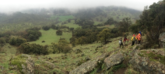
Basics: Access to the Sutter Buttes is extremely limited. Much of the land is comprised of privately owned ranches. The Sutter Buttes Regional Land Trust (formerly the Middle Mountain Foundation) provides guided hikes into the area. This is really the only way for the general public to access the Sutter Buttes. After looking at the scheduled hikes, I naturally picked one of the most difficult ones: the North Butte Summit Ascent.
The hike itself is not actually that long – about 3 miles roundtrip from the parking area to the summit and back. We added an extra mile or two by taking a detour on the way out. It’s difficult because there is no actual trail. The route climbs over 1000-ft at a very steep grade. Despite the short distance, this hike took at least 5 hours. Continue reading “Hiking the Sutter Buttes (North Butte Ascent)”
Ohlone Wilderness Trail
The Ohlone Wilderness Trail connects Del Valle Regional Park (just south of Livermore) to Mission Peak Regional Preserve (in Fremont). The trail is 28 miles long with 7,100 feet of elevation gain including Rose Peak and Mission Peak.
Rose Peak, Mission Peak & 28 miles of Trail in Two Days
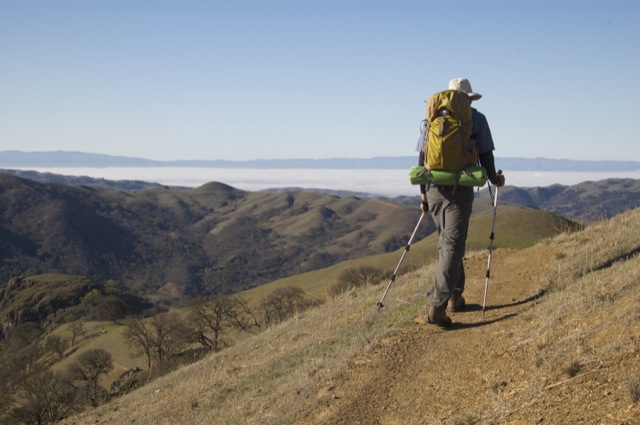
Basics: The Ohlone Wilderness Trail connects Del Valle Regional Park (just south of Livermore) to Mission Peak Regional Preserve (in Fremont). It passes through Ohlone Regional Wilderness and Sunol Regional Wilderness, as well as some land owned by the San Francisco Water District where you’re not allowed to leave the trail. The trail is 28 miles in length, not including short detours to campsites or to the top of Mission Peak. There are many out-and-back options for hiking in this area. A shuttle or other transportation arrangement is required to thru-hike the entire 28 miles. Continue reading “Ohlone Wilderness Trail”