
This is probably one of, if not the most difficult day hike in the Bay Area. Reaching all four of Diablo’s summits requires a full day – it’s 15 strenuous miles with over 6000-ft of elevation gain. We knocked this out in 8 hours. And yes, my legs hurt the next day. Continue reading “Mount Diablo’s Four Summits”
Tag: county highpoint
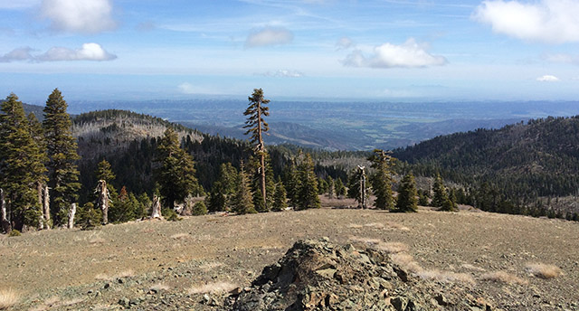
Hiking Lassen Peak
Lassen Peak (10,457′) is the southernmost active volcano in the Cascade Range. It last erupted 100 years ago in 1915. Despite spewing volcanic ash as far as 200 miles away, this most recent eruption is considered very small. Fortunately for us, volcanoes don’t explode without warning and the USGS now monitors Lassen very closely. The trail to the top of the peak is one of the more popular hikes in the park. Most of the trail is above tree-line and the views are stunning. Continue reading “Hiking Lassen Peak”
Snow Mountain
Last week, as I was making plans to visit the Snow Mountain Wilderness, I discovered that the vast majority of people I talked to had never heard of Snow Mountain. This is too bad because efforts are underway to create a Berryessa Snow Mountain National Monument. This would protect the land for future generations while improving coordination between the agencies who plan for fires, manage recreation and clear out invasive species and/or marijuana grow sites. There is already a lot of support for the proposed National Monument, but if more people knew about the area, there might be greater momentum behind the cause. Continue reading “Snow Mountain”
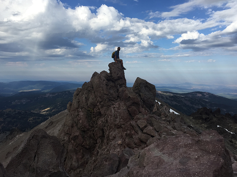
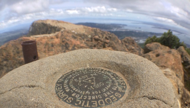
White Mountain Peak
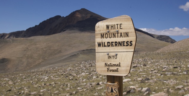
At 14,252-ft, White Mountain Peak is the third tallest peak in California. It is located in the White Mountain range, east of the Sierra Nevada in Mono County. The peak is often considered California’s easiest 14er. A dirt road goes all the way to the summit. Some people reach the top on mountain bikes. The hike is a long one though – 14 miles roundtrip with approximately 2000-ft of elevation gain. Hikers are often defeated and turned back by extreme winds or the high altitude. It is by no means an easy walk. Continue reading “White Mountain Peak”
Mt Tamalpais via the Steep Ravine Trail
If you wanted to, you could drive almost to the top of Mt. Tamalpias. But if you want to really climb Mt. Tam, then start from the ocean. This hike leaves from Stinson Beach and climbs the Steep Ravine trail up to East Peak, then loops back on the north side. The grand total is over 16 miles, and a few thousand feet of elevation gain.
Basics: This hike climbs from Stinson Beach to the East Peak of Mt Tamalpais. It’s a long one – we hiked it as a loop totaling over 16 miles round trip. We reached the top via the Steep Ravine Trail, Matt Davis Trail and Old Railroad Grade road. We returned on the International Trail, Northside Trail, Bay Area Ridge Trail and Matt Davis Trail (among others). Mt Tam has an amazingly large and well developed network of trails and roads. There are many options. Everything is well-signed, but unless you know where you are going, bring a map! Continue reading “Mt Tamalpais via the Steep Ravine Trail”
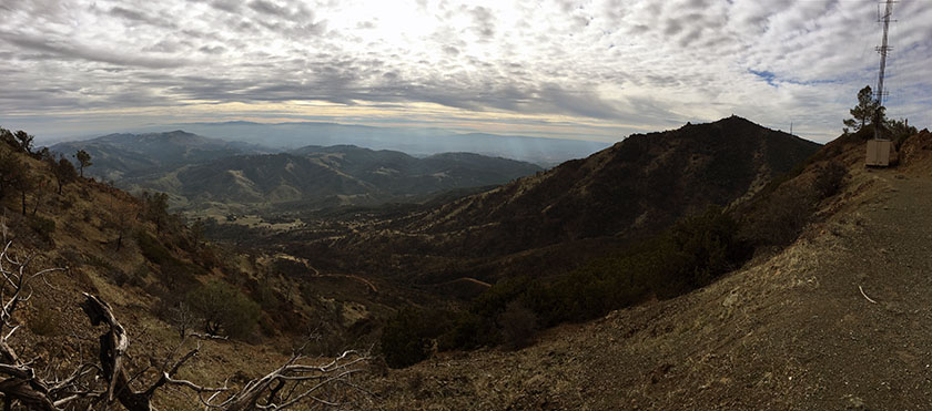
Mount Diablo – Summit Hike

Basics: This is a 14 mile hike to the top of Mt Diablo from Mitchell Canyon (on the northern side of the mountain). There are many trails and many different options for hiking to the top, but all of them will require over 3000 ft of climbing. Our particular route also took us to the top of Eagle Peak (elev 2369′). Two peaks in one long hike! The trail begins at Mitchell Canyon Interpretive Center – located at the end of Mitchell Canyon Road in the city of Clayton. Parking is $6. Continue reading “Mount Diablo – Summit Hike”
Mount Saint Helena
This is a hike to the highest peak (4339 ft) in Sonoma County, though it’s only about 1500 ft or so away from the Napa County line. The hike is 10.2 miles roundtrip, with an elevation gain for around 2300 ft.

In honor of Robert Louis Stevenson’s 160th birthday today, we are proud to present the first post ever on our blog. This trail is located in Stevenson’s own California State Park, where he lived in a cabin and wrote The Silverado Squatters.
Summary: This is a hike to the highest peak (4339 ft) in Sonoma County, though it’s only about 1500 ft or so away from the Napa County line. This trail follows a gently graded fire road, so in cool weather it’s fairly easy despite the distance. The hike is 10.2 miles roundtrip, with an elevation gain for around 2300 ft. Parking is free on the side of the road.