
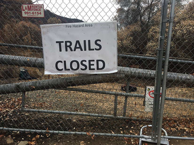
On a Wednesday afternoon last July, I had just gotten home from work when I noticed the sky to the west was filled with smoke. It didn’t take long to figure out that this was a wildfire somewhere near Lake Berryessa. The Wragg Fire would go on to burn more than 8000 acres in Napa and Solano Counties, including most of the Stebbins Cold Canyon Reserve. We’ve been hiking the trails in and around this area for several years, so we’ve become quite familiar with Cold Canyon. Today we had the opportunity to go behind the gates and see some of the fire damage. Continue reading “Stebbins Cold Canyon after the Wragg Fire”
Tag: out and back
Smittle Creek Trail
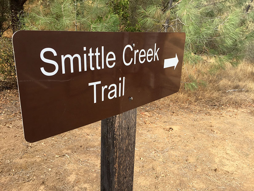
Smittle Creek might be the least exciting hike we’ve gone on this year. I think it has the potential to be really nice – if Lake Berryessa had more water in it and if the hills were green, things would look very different. Nevertheless, with Stebbins Cold Canyon still closed to the public after the Wragg Fire, we’ve been driving a little further to find new trails. Despite the somewhat drab landscape, I actually really enjoyed this trip. The soft dirt trail is perfect for running. We also found it to be incredibly quiet and peaceful: very few people visit Lake Berryessa this time of year. Continue reading “Smittle Creek Trail”
Hiking the Lost Coast Trail
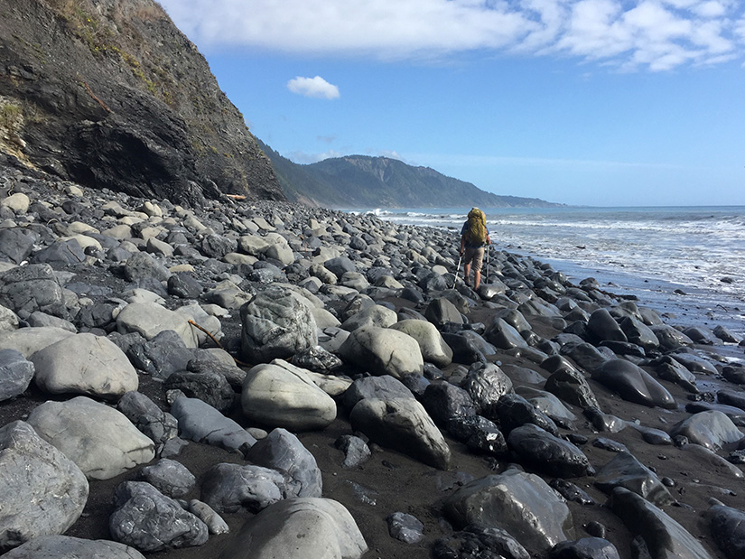
The Lost Coast is the most rugged, undeveloped stretch of coastline in California. There are no highways or major roads in the area. It was named the “Lost Coast” after the region experienced depopulation in the 1930’s, but the name still seems appropriate today considering the isolated nature of the place. Continue reading “Hiking the Lost Coast Trail”
Kings Creek Falls Trail
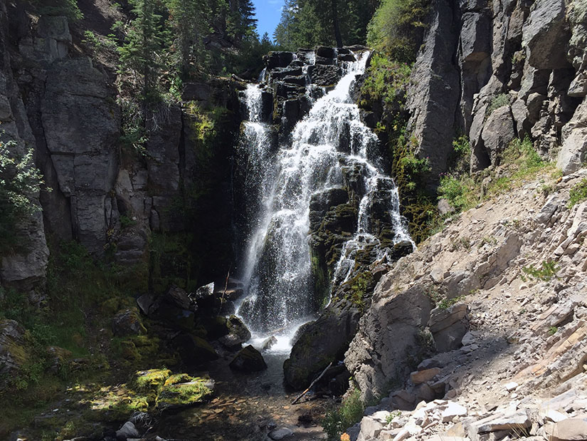
A waterfall hike might not be the first thing that comes to mind in the midst of a severe drought. Nevertheless, after hiking the Lassen Peak Trail, we decided to check out the nearby Kings Creek Falls and upper cascades. We were pleasantly surprised by the amount of water in Kings Creek. Continue reading “Kings Creek Falls Trail”
Snow Mountain
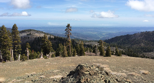
Last week, as I was making plans to visit the Snow Mountain Wilderness, I discovered that the vast majority of people I talked to had never heard of Snow Mountain. This is too bad because efforts are underway to create a Berryessa Snow Mountain National Monument. This would protect the land for future generations while improving coordination between the agencies who plan for fires, manage recreation and clear out invasive species and/or marijuana grow sites. There is already a lot of support for the proposed National Monument, but if more people knew about the area, there might be greater momentum behind the cause. Continue reading “Snow Mountain”
Pleasants Ridge – Putah Creek Wildlife Area
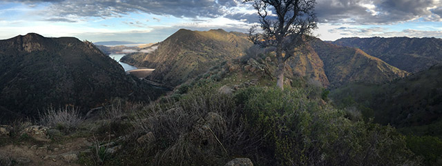
Pleasants Ridge is one of those trails I’ve passed by and ignored on many occasions. We are frequent visitors to the Stebbins Cold Canyon Loop, but we rarely branch out to any of the other trails in the area. The Pleasants Ridge hike starts at the same trailhead – just off of Highway 128 in the Putah Creek Wildlife Area. Roundtrip distance is about 2 or 3 miles, depending on how far you want to go. We followed the trail to the end of the ridge. The last half mile or so is very overgrown and does not see a lot of visitors. Continue reading “Pleasants Ridge – Putah Creek Wildlife Area”
Pyramid Peak via Rocky Canyon
We’ve attempted and failed to hike Pyramid Peak more times than I’d like to admit. Poor planning, late starts and crappy weather have all thwarted past attempts. Our friend Nolan has had a similar experience. After climbing far more challenging peaks, we (jokingly) began to wonder if we’d ever make it to the top of “the elusive Pyramid Peak.”
Finally, this past weekend we made it happen. The weather was looking to be perfect. We chose the most direct route – Rocky Canyon from Highway 50. We were determined to finally knock this one off our list. Continue reading “Pyramid Peak via Rocky Canyon”
Yosemite Valley to Glacier Point: Four Mile Trail
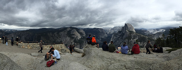
The Four Mile Trail (actually 4.8 miles) is one of Yosemite Valley’s most strenuous trails. It climbs up to Glacier Point – an ascent of nearly 3300-ft in just under five miles. After the grueling uphill slog, hikers are rewarded with unparalleled views of Half Dome and the rest of Yosemite Valley. Glacier Point can also be reached by car or shuttle, but the view feels much more rewarding when you walk. We hiked this on a rainy Saturday in late September. Though summer is over, there were still plenty of people out and about. You can’t expect much solitude on this trail, but you can look forward to a great workout and some good people watching! Continue reading “Yosemite Valley to Glacier Point: Four Mile Trail”
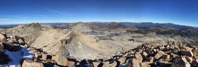
White Mountain Peak
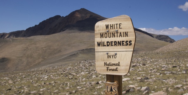
At 14,252-ft, White Mountain Peak is the third tallest peak in California. It is located in the White Mountain range, east of the Sierra Nevada in Mono County. The peak is often considered California’s easiest 14er. A dirt road goes all the way to the summit. Some people reach the top on mountain bikes. The hike is a long one though – 14 miles roundtrip with approximately 2000-ft of elevation gain. Hikers are often defeated and turned back by extreme winds or the high altitude. It is by no means an easy walk. Continue reading “White Mountain Peak”
Mount Williamson via Shepherd Pass
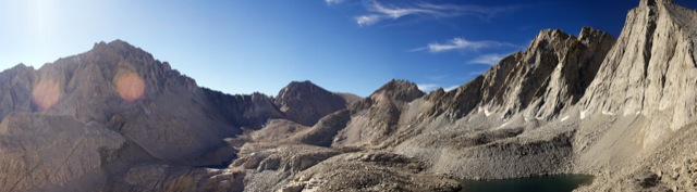
There is nothing easy about climbing California’s second tallest peak. The approach is long (over 26 miles round trip) and involves climbing nearly 10,000 ft. Some super humans have day hiked this peak. We took three days to do it and it was still quite a challenge. Continue reading “Mount Williamson via Shepherd Pass”