
Rose Peak, Mission Peak & 28 miles of Trail in Two Days
Basics: The Ohlone Wilderness Trail connects Del Valle Regional Park (just south of Livermore) to Mission Peak Regional Preserve (in Fremont). It passes through Ohlone Regional Wilderness and Sunol Regional Wilderness, as well as some land owned by the San Francisco Water District where you’re not allowed to leave the trail. The trail is 28 miles in length, not including short detours to campsites or to the top of Mission Peak. There are many out-and-back options for hiking in this area. A shuttle or other transportation arrangement is required to thru-hike the entire 28 miles.
Permits and Fees: The East Bay Regional Park District website is the best resource for information on permits and fees, but here is a short summary:
Permits (one per hiker) are required for almost all portions of the Ohlone trail. Permits can be purchased at the park kiosk, online, or via phone when making a campsite reservation. The permits are great! They are a nice trail map and they contain wealth of information.
There is a fee to park at Del Valle, and overnight parking passes are required if you are leaving a car at either end of the trail.
Reservations are required to stay in any of the backcountry campsites. Call 1-888-EBPARKS or 1-888-327-2757 (press option 2).
This may sound like a lot of red tape, but I made one phone call and was able to get the hiking permits, the campsite reservation and parking passes at the same time. The EB Parks people are very helpful.
Directions to Trailhead: We began our hike at Del Valle Regional Park. To reach the park, exit I-580 in Livermore at North Livermore Avenue. Head south through town and continue on North Livermore Avenue as it becomes South Livermore Avenue. About 1.5 miles outside town, turn right at Mines Road, go about 3.5 miles and continue straight on Del Valle Road (Mines Road goes left). The park entrance is about four miles ahead.
These directions, along with directions to the other parks encompassing the Ohlone Wilderness Trail can be found on the East Bay Regional Park District website.
Day 1 (Del Valle to Rose Peak – 10 miles)
We started our trip with a big breakfast in Mountain View at Olympus Caffe & Bakery. Well, maybe I only had a bagel… but Rob ate a huge Greek omelette with a side of hash browns and iced coffee. I got some spanakopitas ‘to go’ so we’d have something delicious on the trail. My brother Michael was kind enough to help shuttle us to our trailhead, so after breakfast we drove two cars to the Mission Peak trail on Stanford Ave in Fremont. It was around 8:00am on a Saturday and the place was a complete zoo. We parked blocks away from the trailhead, and we were lucky to find a spot just as somebody was leaving. We hopped in my brother’s car and headed for Del Valle.
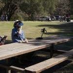
The parking lot at Del Valle had plenty of room – far fewer people on this side of the Ohlone Wilderness Trail. It was a bit of a relief after seeing the crowds at Mission Peak.
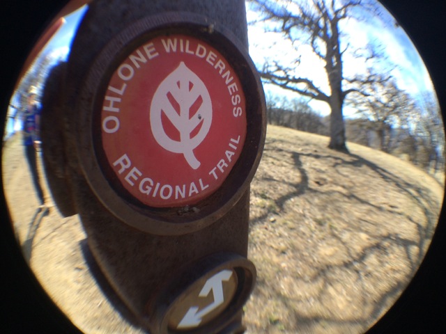
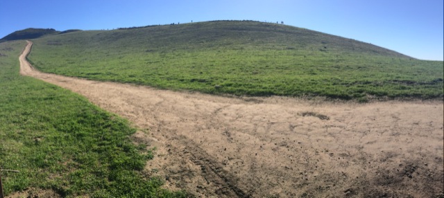
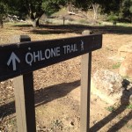
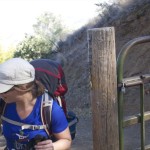
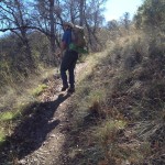
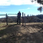
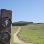
From the parking lot the trail immediately begins a steep climb. We hiked uphill for almost a mile before reaching the Ohlone Trail sign-in panel. Beyond this point, permits are required.

After signing in, we continued the uphill climb towards Boyd Camp and the junction with the Rocky Ridge Trail. From there, the trail heads downhill towards Williams Gulch. Before reaching the creek, we took a short break. My brother had hiked with us until this point. After eating our spanakopitas (yum!) we headed onwards and Michael turned around, hiking back to his car via the Rocky Ridge Trail.
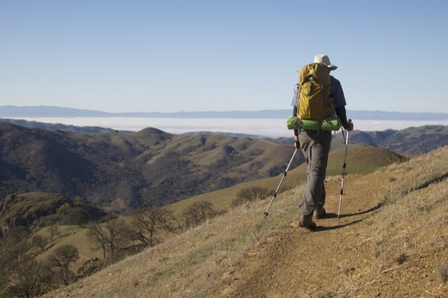
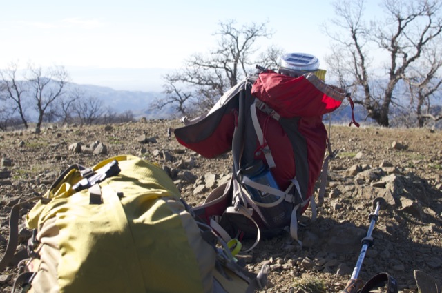
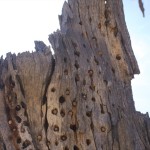
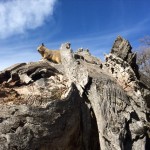
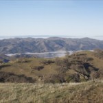
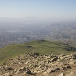
After Williams Gulch is the Big Burn! We climbed nearly 1200′ in less than 2 miles. It was still relatively cool outside so it wasn’t too bad. At the top of the Big Burn (yes, it’s actually labeled that way on the map), we reached Shlieper Rock – a large rocky outcropping overlooking the oak covered hills. We sat and rested.
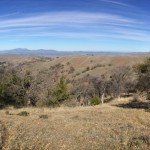
After Schlieper Rock, we hiked almost nonstop to the top of Rose Peak. We did take a short break to collect and eat some pine nuts we found under one of the many grey pines. Rose Peak is about 10 miles from the trailhead and we made it to the top with plenty of daylight to spare.
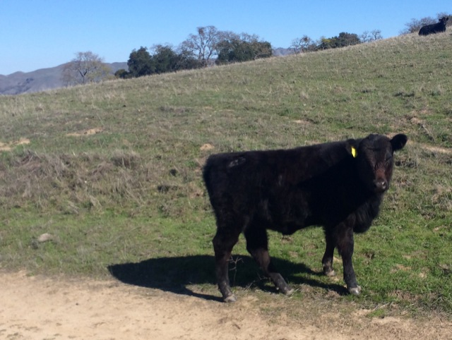
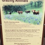
From Rose Peak, we headed down towards Maggie’s Half Acre. We walked past some very agitated cows on the way down – they actually chased us down the hill a ways. Perhaps I was overreacting, but these cows did not seem friendly and I was very nervous.
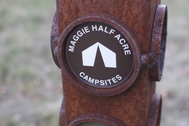
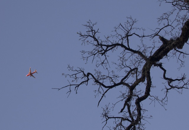
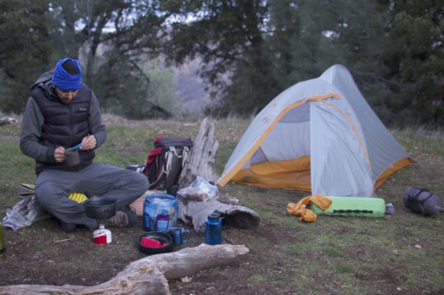
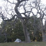
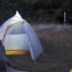
Maggie’s Half Acre is less than half a mile from Rose Peak summit. The camp has a pit toilet and water that is labeled as “potable” on some signs and “untreated” on others. There are three campsites and all were booked for the night. One very large group of boy scouts was occupying the site next to us. The sites all have plenty of space between them, so it didn’t feel crowded. We set up the tent, cooked dinner and went to bed early. Planes flying in to SFO kept us awake for a little while, but eventually the airport rush hour tapered off and all we could hear was the occasional hoot of an owl.
Day 2 (Rose Peak to Mission Peak & Stanford Ave – 18 miles)
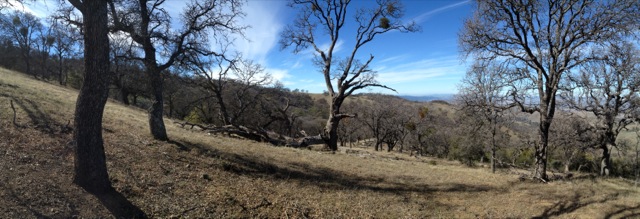
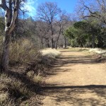
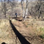
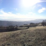
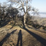
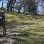
We broke camp early because we had 18 miles ahead of us. The first 10 miles of our day were mostly downhill to Sunol Regional Wilderness. We hiked through grassy oak woodlands and saw many woodpeckers and ground squirrels. There were also lots and lots of cow patties (or plops as Rob called them). Despite all the cow plops, it was quite beautiful. We passed two or three separate herds of cows. We were quiet and made wide arcs around them so as not to repeat the previous evening’s experience.

We made it to the Sunol Visitor Center by about 12:30pm. We refilled our water bottles and ate an entire block of cheddar cheese with crackers. I was a little nervous about the 8+ miles ahead of us. We had a lot of climbing to do, and I was already pretty tired from hiking 10 miles. The lunch break did help, and soon we were on our way towards Mission Peak.
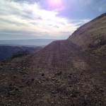
From Sunol, the trail passes through a large section of property owned by the SF Water Department. For a long time we were on a gravel road, winding up the shady side of the mountain. It was a gorgeous sunny warm day; I was glad so much of the trail was shaded. We passed a few more cows, but these cows seemed more used to people. They continued to graze as we walked past them.
Eventually, we reached Mission Peak Regional Preserve. From the sign-in (or sign-out) panel at the border, it would be another 4.8 miles to the Stanford Ave staging area. Of course, once Mission Peak was in view, I decided we should hike up it! This added another mile to our trip.

As soon as we reached the junction with the Peak Trail, we were back in the zoo of people. We made the quick hike to the top, then headed down to the car as quickly as possible. “Quickly” by this point was not so fast because we were both very sore. It was amusing to watch the endless stream of people coming up and down the trail as we hiked. Great people watching, but not great solitude.
We made it back to the car before 5:00pm. We hiked 18+ miles in a little over 9 hours, including breaks. Not too bad!

As I recall about 20 years back, we hiked the Rose Peak thing from Del Valle to Sunol with the PCS doing the shuttle, some 20 miles, then, and Rose Peak out and back from Sunol. Never had much interest in overnight with the cows and all, seeing how for the same or less driving we’d have the Sierra, no or smaller crowds. Permits now, nice to know, I’d do it for 4G in camp, if that is the case.
It sounds like you’ve done almost all of the trail, just in a different manner. The section from Rose Peak to Sunol was one of my favorites.
The cows are definitely a little weird, but fortunately they kept to the open pasture and our campsite was well away from any signs of them.
Yesterday I day hiked the trail as a training hike for the PCT. I start next month! I love the google map and the altitude graph of the trail! I want to embed it on my blog. Can you give me directions on how to do it?
The Pacific Crest Trail, wow! I’m hoping to do that at some point as well. I wish you luck! The Double Dipsea would also be a good training hike.
It looks like your blog is on Blogger, so you won’t be able to use the wordpress plugin that I use: Google Maps GPX Viewer. Usually I record my tracks with the MapMyFitness app, which has a great “embed” code for maps with elevation profiles that you could use (though I favor the wordpress plugin). But for this overnight trip I didn’t want to use all my phone battery so I made the elevation profile entirely using Open Street Map track data on the website GPSies.com. Here is a link to the track shown on the map. You could use the “embed” code from GPSies.com as well to put it on your blog.
Thanks for the training hike suggestion and the Google map info. I’ll check it out!
Loren, while I like to hike and have done 100 miles in 8 days along the JMT, my first time out long distance, I decided that it’s just too expensive and drudgery to hike the whole PCT. I ran into a couple guys who said that they were doing it, and it looked miserable. Tired, too much sun, those guys were dedicated but some of them gave up about Oregon. I’ve been hiking the best parts, and seek to hike the better portions of the CDT as well, but there’s very little info online. The CDT is incomplete, with maybe 700 miles with no trails. Then long stretches are boring and not wilderness. Hey Nor Cal Hiker, I can help out with simple, cheaper assist, if interested. If by Donner Summit, say, I can provide transport into Sac, say, as a short break from hiking, with arrangements, and offer some fine dining, on me, to hear about your backpack!
Great write up.
What month were you on the trail? I see your post was from February.
Thanks! Yes- it was February, but in a drought year. It’s usually a little muddier in the winter, but still a nice trail.
Impressive! Just got back from a 3-day hike from Del Valle RP to Sunol Visitors Center, leading a Scout crew preparing for Philmont. We camped on Day 1 at Stewart’s Camp; even at this distance (6.5 miles), the ~3300 ft of climbing was pretty challenging for our crew. We made it to Rose peak on day 2, before arriving at Eagle’s Eyrie at the Sunol Backpack camps. I think my Scouts were very angry at me since I promised them day 2 was long (10.5 miles) but without much climbing…I was only correct in that there was *less* climbing on day 2. Fortunately day 3 was an easy 3.5 to the Visitor’s Center!
Thanks for sharing your trip notes. Very helpful in setting expectations, since I had never been there!
Day one we hiked from Stanford Avenue to Sunol backpack camp for 10.9 miles and 3390 vertical feet, according to Caltopo (not including the 400 foot climb to Mission Peak).
Day two we hiked from Sunol backpack camp to Stewart’s camp for 10.25 miles and 3385 vertical feet, with a detour up to Rose Peak of course.
Today on day three we hiked from Stewart’s camp to Del Valle for 7 miles and 1055 vertical feet. Because it was 40º and raining we did not take the detour to Murietta Falls.
As you can see this is an evenly paced, doable route. If you can climb Mount Diablo two days in a row with a pack, you can do this.
So it is unfortunate that there is only one spot at Stewart’s camp, limiting this route’s availability.
There are seven spots at Sunol backpack camp, but beware, each one varies in the number of tent sites. I reserved Sycamore for the three of us and there was only one tent site. So we poached Hawk’s Nest and fortunately no one showed up. When making a reservation for Sunol backpack camp, tell the agent that you need a space that can hold “x” amount of tent sites. Also, the water faucet can be found above Hawk’s Nest.
The water at all the backpack camps is spring fed, and I didn’t filter it. Just saying.
Beware #2: Went off trail to sit on a log and fortunately spotted the giant rattlesnake sunning itself behind it.
I got a kick out of seeing Loren Mauch’s comment from 2014. I met Loren in 2017 on Mount Diablo. He did complete the PCT and the CDT. For training he hiked the Ohlone Trail in a single day more than once. He hiked the Double Dipsea per your suggestion, and we also hiked it together.