

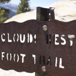
It’s no surprise Yosemite is one of the most visited National Parks in the country – the place is beautiful. Backpacking is a great way to get away from the crowds of Yosemite Valley. The trails are still more heavily travelled than many others in the Sierras, but the scenery is unbeatable. There are several different ways to get from Tuolumne Meadows to Yosemite Valley. Our route took us over Clouds Rest and up Half Dome.
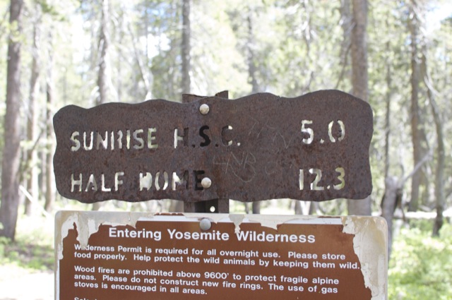
Red Tape: Overnight trips anywhere in Yosemite require a wilderness permit. The NPS website has plenty of helpful information on how to secure a permit. It can be a bit of a lottery, so it’s good to be flexible and make reservations well in advance. Additionally, hiking Half Dome now requires a permit 7 days per week. There is a lottery system for day hikers, but it’s also possible to secure a permit when reserving the backpacking permit. Once all permits are secured, it’s a good idea to reserve bus tickets from Yosemite Valley to Tuolumne Meadows. There is only one shuttle per day and it fills up! Information can be found on the DNC website. In the summer, it’s also possible to take YARTS. We did not have this option (weekday service hadn’t begun in June) so I didn’t really research it, but I do know YARTS is slightly cheaper than the DNC tour bus.
Trail Description: We spent 5 days and 4 nights on the trail. We planned to visit May Lake and Mount Hoffman on Day 2, but a freak rainstorm kept us at Glen Aulin for a second night. We covered a total of nearly 40 miles with over 5000 feet of elevation gain and 9000 feet of descent.
- Day 1 – Tuolumne Meadows to Glen Aulin, 6 miles
- Day 2 – Glen Aulin, 0 miles
- Day 3 – Glen Aulin to Sunrise Lakes, 10 miles
- Day 4 – Sunrise Lakes to Little Yosemite Valley, 10 miles
- Day 5 – Half Dome Climb and Yosemite Valley, 13 miles
Day 1: Tuolumne Meadows to Glen Aulin
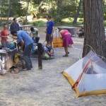
We drove to Tuolumne Meadows from Groveland early in the morning. Picked up our permit at the Wilderness Center (not to be confused with the Visitor Center), then waited at the Glen Aulin trailhead for the rest of our 8-person group.
While we waited, a few backpackers parked nearby and began fiddling with gear. One guy took quite some time packing is 80L pack. Soon he looked ready to hit the trail, but suddenly he snapped his sunglasses in half. After some amount of cussing and laughter, we gave him a loaner pair of sunglasses that we keep in the car – ridiculous yellow hipster sunglasses picked up for free at a beer festival. We concluded: the new sunglasses really tied his whole outfit together. After more laughter, he was on his way. Soon after, so were we.
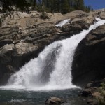
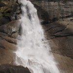
The hike was easy: only about 6 miles and relatively flat. There are beautiful waterfalls along the Tuolumne River. One particularly large cascade is right next to the Glen Aulin High Sierra Camp. We swam in the river, relaxed, had tacos for dinner and drank wine. Bags of wine (taken out of boxes) make for a great backpacking treat. Onwards to May Lake tomorrow!
Day 2: Glen Aulin (Again)
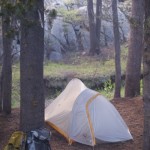
Rain! Woke up to the sound of rain on the tent at around 4 AM. I was the only one who had put my boots under the vestibule. Rob frantically ran around putting boots under vestibules and leaning backpacks against tree trunks. The towel and socks I had left out to dry the day before were soaked in the morning. Turns out, our tent (the very lightweight Fly Creek UL2) does stay nicely dry in the rain!
It continued to drizzle throughout the morning. After soggy breakfasts and some debate, we decided to stay put. Nobody wanted to pack up wet tents and hike in the rain.
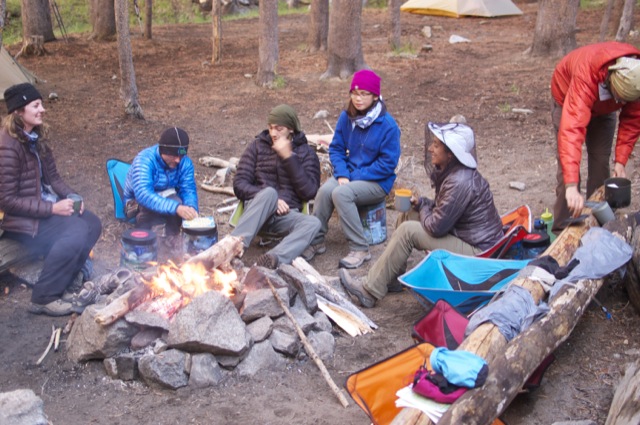
At around 10 AM, Rob magically started a fire with some dry sticks he found under a rock. I’m not sure how, but we kept the fire going for the next 12 hours or so.
We ate, sat around, and met other campers including a PCT hiker named Eddie who provided some entertainment in the form of board games! We snagged some ponchos and trash bags from the High Sierra Camp “store” and used them to stay dry. (None of us were really prepared for rain.) Eventually the rain stopped and we dried out our stuff around the fire. By the time we went to bed, we were all exhausted, despite having hiked zero miles.
Day 3: Glen Aulin to Sunrise Lakes
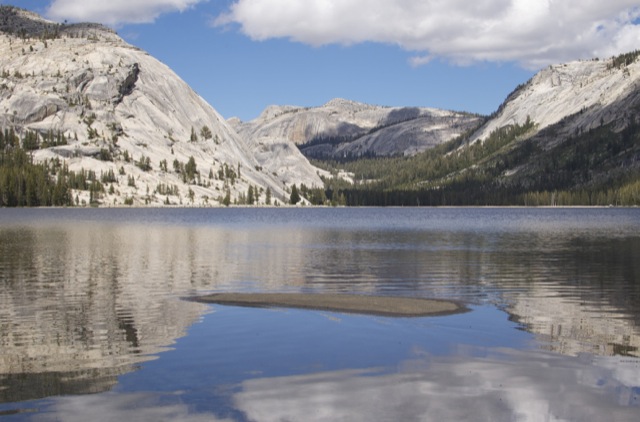
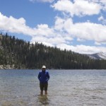
Today we finally moved onwards. We skipped May Lake and headed straight towards Tenaya Lake (to the south). The trail had some ups and downs, but overall was pretty easy. We took a long lunch break and soaked our feet in Tenaya Lake. From there, we continued towards Sunrise Lakes and Clouds Rest.
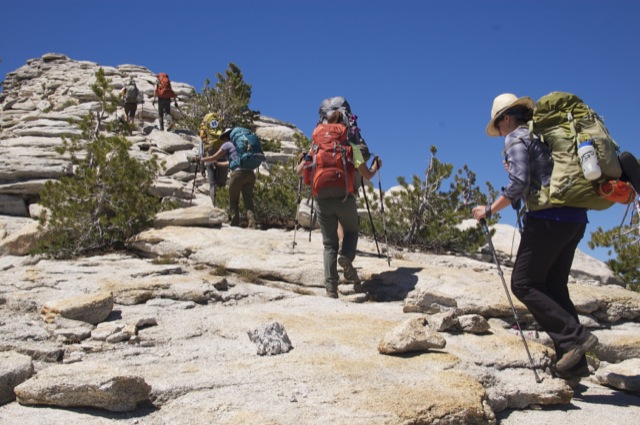
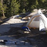
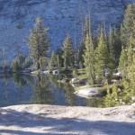
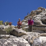
The Sunrise Trailhead is the primary starting point for day hikers who wish to visit Clouds Rest. We crossed paths with many more day hikers than we had seen previously. The trail was flat for a few miles, then climbed steeply before reaching the short detour trail to Sunrise Lakes. It was a long, slow slog up the hill, but we reached the lower lake early in the evening and set up camp.
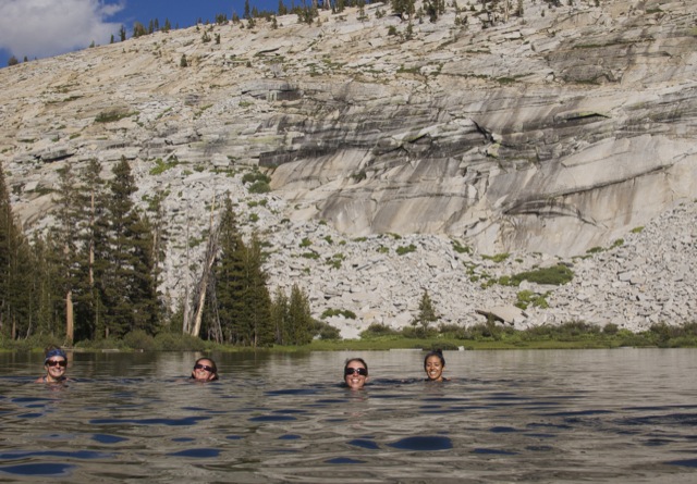
The bad: mosquitoes were terrible today. The good: we swam in the lake and had epic views while we cooked dinner.
Day 4: Sunrise Lakes to Little Yosemite Valley
Woke up to a beautiful sunrise over the lake. Not a cloud in the sky and no chill in the air – we had a hot day ahead of us.
The mosquitoes began to attack as we cooked breakfast. Rob and I made flapjacks with bananas and peanut butter – yum! We packed quickly.
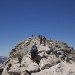
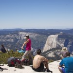
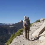
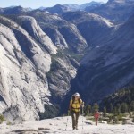
We hiked uphill – gradually at first then steeply as we approached Clouds Rest. Views were amazing. The approach involves hiking along a ridge with a steep drop off on each side. It was a little unnerving, especially with how crowded the trail was.
After a long lunch at the top, we continued down the other side towards Little Yosemite Valley. Far fewer people on this trail (most start from Tenaya Lake and do not come up this side). After many miles and many switchbacks through the forest, we reached Little Yosemite Valley and set up camp.
We all went for a quick swim in the Merced River and mentally prepared ourselves for climbing Half Dome in the morning.
Day 5: Half Dome Climb and Yosemite Valley
Woke up early and began hiking by 6:30 AM. We retraced our previous day’s steps for 1.5 miles. After 30 or 40 minutes we reached the Half Dome Trail junction. From there, it was another 2 miles up to the bottom of the cables.
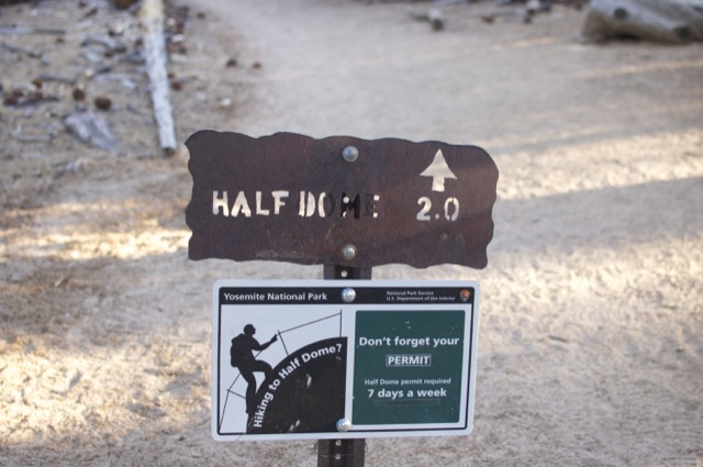
No ranger was present at the base of the sub-dome (we were still too early!) We took a short break before heading up the cables. Again, it was a slightly unnerving climb. A large group came down as we headed up. Talking to them and seeing how panic stricken some of them were made me feel a lot better about my own abilities.
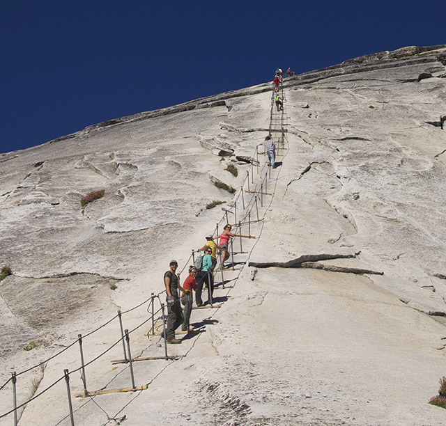
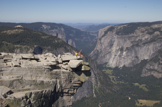
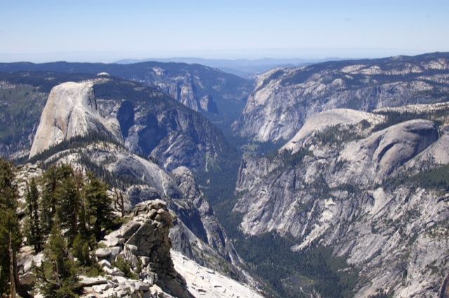
We reached the top in no time! Took lots of pictures, ate some snacks, then headed down. It was now a zoo on the cables. I did think going down was easier than up, but it would have been much more difficult without gloves!
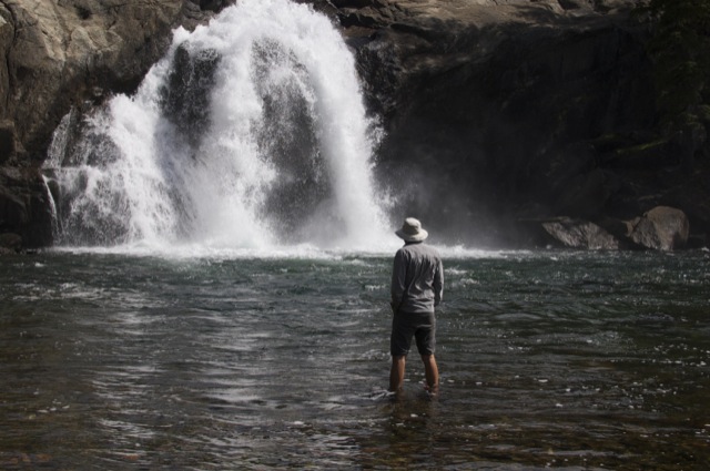
As we headed down the trail, we ran into a ranger who checked our permit. We reached LYV sometime around midday. We packed our gear and made our way towards the Mist Trail. The weather had steadily warmed up and it was downright hot by the time we reached Nevada Falls. Not quite enough mist or shade along the Mist Trail for a day like today!
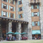
It took quite a few hours to weave through the crowds and get down the granite stairs. We reached the Backpacker’s Camp in Yosemite Valley at around 5:30 PM. Long day! After setting up camp, we again swam in the Merced River. Topped the day off some beers at the Ahwahnee Hotel followed by pizza at Curry Village. By the time we left Curry Village it was dark and we barely found our way back to camp. Luckily, a nice shuttle driver gave us a ride even though it was late and her bus had already gone out of service.

The following day we awoke early and caught the hiker’s bus back to Tuolumne Meadows. This shuttle also happens to be a tour bus. Maynard, our chauffeur spent most of the drive talking about Yosemite’s history and pointing out interesting sites. He had a wealth of interesting information, but his soothing voice lulled many of us to sleep.
After a quick lunch at the Tuolumne Meadows Grill, we hit the road and headed back to reality.


Another great blog and pics guys and girls, thanks for sharing. Except for the rain and the mosquitoes it looked like fun.
Thanks Lorenzo! Yes – the mosquitoes were bad. We ran out of bug spray. The rain was kind of a bummer, but the upside was that it really cleared out the air. We were able to see all the way to the Coast Range from the top of Clouds Rest! Glad you enjoyed the post.
Brings back memories from 43 years ago. Though I did CR 4X a few years ago, never any takers from then on. Interesting to see people still backpack, it’s long been banned by the SC here.
Very cool write-up. Just out of curiosity, what were the trailheads you put down on the permit application? Or did you even have to do that at the time?
Thanks! Our permit was for Tuolumne Meadows trailhead with a first night at Glen Aulin.
Great write-up and trip! Did you have to reserve a campsite at Yosemite Valley or was your wilderness permit sufficient since you were backpacking? Same question on campsite at Glen Autin for the first night?
Thanks Dwain! We did not need a campsite reservation in Yosemite Valley. Any backpacking permit allows you to stay in the Backpacker’s Campground one night before your departure date and one night after your return to the Valley. When you make a permit reservation in Yosemite, you tell them which trailhead you plan to leave from, and where your first night’s campsite will be. Thus, we sort of had a Glen Aulin reservation, but not an official tent cabin reservation or anything like that. There’s a lot of space to spread out around Glen Aulin.
Which trailhead in Tuolumne did you get a permit for to do this?
Hi Chris. We got the Glen Aulin trailhead permit for this one.
Have you ever done this hike in the opposite direction?
I’ve been thinking about starting in the valley and ending in Tuolumne Meadows.
Do you have any reasons on why to do it the way you did?
We did a portion of this hike in the opposite direction when we hiked the John Muir Trail. We started at Happy Isles and reached Tuolumne Meadows, but by a slightly different route. When we planned this particular trip, I felt that it would be easier to get permits for the trailhead in Tuolumne Meadows. Also, the hike from Tuolumne is more downhill than uphill, and I preferred hiking downhill at the time. (I think my knees would feel different now.) I wouldn’t mind hiking this route in either direction!
Thanks for the response Christa!
Reading about this really put me in a ‘happy ‘place’. What month did you do this hike? I was thinking of trying to do it as early as Tioga road opens, or as soon as the shut starts .
Thanks Todd! This was late June in a relatively dry year. It would definitely be nice to hike this in the off season (especially around the time Tioga Pass closes.) In 2016 we hiked from Tuolumne Meadows to Glen Aulin on the PCT, right after the road opened in early June. It was the first really warm week of the summer and there was quite a bit of snowmelt. The entrance to Glen Aulin flooded and the trail had a lot of water on it. Not sure I’d want to repeat that experience.
The website that linked to yours said there is also a 3 day trip that is 9 miles a day. do you have any alternative trip advice that we could put on the permit?
Yes- Glen Aulin is a bit of a detour, so you could hike directly from Tuolumne Meadows to Sunrise Lakes. This would make it a three day trip.