
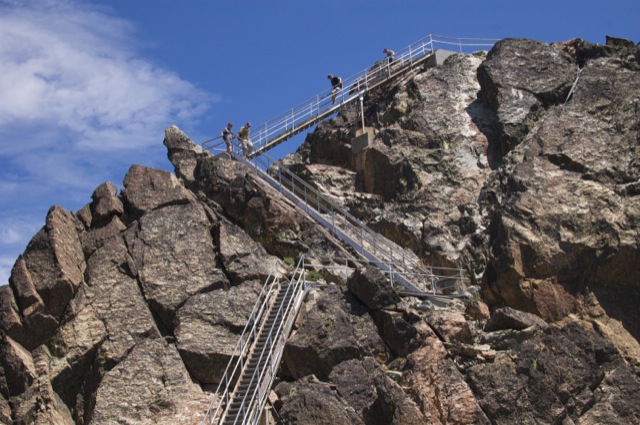
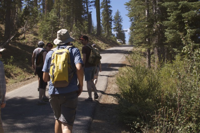
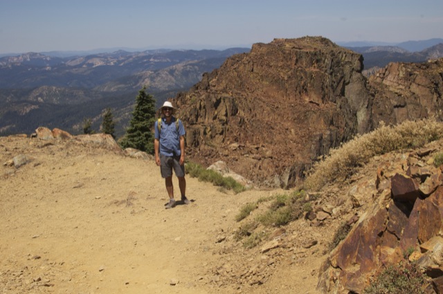
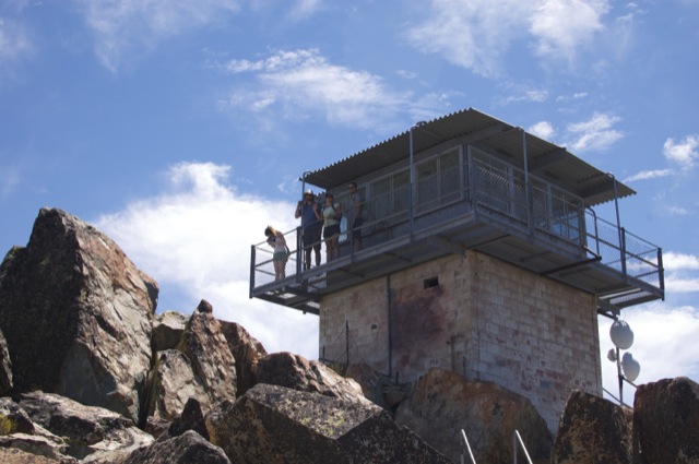
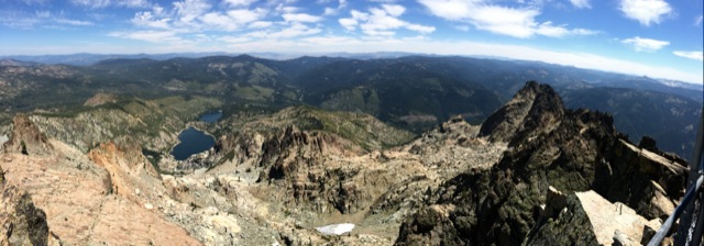
The hike to the Sierra Buttes Fire Lookout is about 5 miles (out and back) with a climb of 1500 feet (or more if you start at a different trailhead). It’s a pretty cool destination! We went with a group of 14 people and even the non-hikers seemed to enjoy the lookout! The top (at 8587-ft) provides views down to Upper/Lower Sardine Lakes, the surrounding Sierra Buttes and many miles of Tahoe National Forest.
Directions to Trailhead: From Sierra City, head northeast on Highway 49 for about 5 miles. Turn left on Gold Lake Highway. After 1.3 miles, turn left again on Packer Lake Road. Follow signs for Packer Lake, turning right at the split. Shortly before reaching Packer Lake, turn left on Co Rte 621 (marked with a sign reading: Sierra Buttes). Follow this road up a steep grade until you reach a wide junction with many parking spots (Packer Saddle). Turn left on Butcher Ranch Road and follow it south for 0.6 more miles, ignoring the split to the right. The trailhead has a wide dirt area for parking and is marked with trail signs for both the Sierra Buttes Lookout and the PCT. Google Map link to trailhead.
Trail Description:
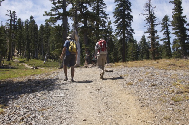
I don’t have any entertaining stories or tales of woe from this hike. All I can say is there was 14 of us humans plus one rockstar chihuahua. There were some blisters, but everyone made it to the top. Success! I will let the photos do the rest of the talking:


In reading other trail logs/descriptions, I noticed that a few people have gotten a bit lost on this trail. This route gets pretty crowded; if you’re totally lost, simply follow the people in front of you and hope that they are not southbound PCT hikers. Otherwise, here is a very dry description of the hike:
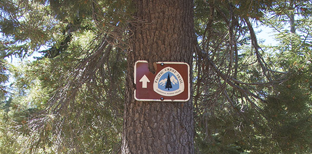
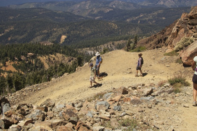
- From the trailhead on Butcher Ranch Road, hike uphill along either the PCT or the OHV road until you reach an obvious junction (0.5 miles in). Turn right and hike along the PCT. Do not take the left trail heading downhill.
- At just over a mile from the trailhead, the PCT splits to the right. Take the trail to the left, heading uphill along the ridge towards the lookout.
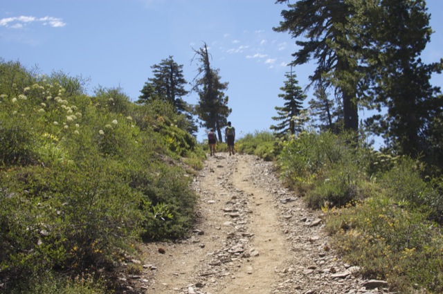
- Less than a mile further, the trail joins back up with the OHV road. Follow this wider road up the switchbacks to the top of the peak.
On my 8X, I ran into three guys doing the PCT. They gave me a website name so I could follow their posts. I think one or some of them dropped out about Oregon, as by them it wasn’t fun anymore. I offered to give a ride into Reno, but couldn’t drop them back off where they left off. I’ve have treated them to steak and lobster or given them the op but they seemed to prefer tortillas with peanut butter, pretty dedicated hikers.
fgfg
gf
gfgfgfggffgfgfggf
dnv[ dj[wjg[wjg[fjs gfskg’rekgorkgokggkkkkkkk
ffggffggffggerikffggffggisffggffggawesomeffggggg!!!!
Thank you thank you THANK YOU!! Your post saved me and my trip to Sierra Buttes Fire Lookout yesterday. I got lost (only) 3 times on my way to the “parking lot” and then I found your “Directions to Trailhead”! Thank you!
I completed the hike on June 14, 2021. The trail was quite difficult to follow coming down. There were patches of snow which complicated the trail search effort (at about 7,800 ft.). Everything seems to look the same in the forested environment. I was one of the last to return (I know there were two women before me – they were going up when I was coming down; it was 2.50 p.m. when I left the top – near the foot of the stairs; there was no one at the Lookout when I left). I hike alone, which makes it a challenge, as I am not sure how much time I would have spent looking for the correct trail. I decided to take the “quick” way down, which is via a wide jeep trail that connects to Butcher Ranch Rd. I have a compass and an altimeter, but no map. I recalled the trail head map indicating this “jeep trail”, and that I should ignore any left turns; keeping right on this “jeep trail” going down would connect me to Butcher Ranch Rd. It was a longer route, but, seems clear to me at that time. Eventually, I ran into a road sign with arrows pointing toward the Lookout and to Sierra City – 5 miles away…a good thing, it helped boost confidence. I checked my altimeter and compass; the former says 6,520 ft., and the road I am on heads “dead North”. Both are good indication I am on the right road (before I left, I noted the Lookout Parking Lot at 6,580 ft.; and the Trail Head map shows the road I am on to be along the North-South axis). About 1/2-hour later, while hiking along Butcher Ranch Rd., I got lucky, running into a family in a pick-up truck, heading towards the Lookout Parking Lot. The family was nice to offer me a ride!
I first scaled the face of the Buttes from Sardine Lake when I was 17, back in 1948. In a sort of celebration of my 90th, I’m taking my three grandsons (all well into adulthood) up the easier, trail way in October. Thanks for the directions and tips — I’ll need them all.
That is awesome!! Enjoy the hike!
A heads up. On the descent, it’s easy to miss the right turn from the DHV road onto the trail. There is no marker. If you go pass this turnoff, another, inviting right turn presents itself soon. This may be the road that George took (see above), and it takes you pretty far afield, a VERY long way round to the trailhead parking lot. My advice: On the way up, near the top, where the trail meets the DHV road there’s a sign in front of you directing you to the Lookout. Watch for this sign on the left, coming down. It will confirm that you’re making the correct turn.
You’re right regarding the long way to the parking lot. Lucky to catch a ride on the pick-up truck!
Mike, I climbed to the tower in the summer of 1972. I met the man who stayed there from April till Sept. .In side was a 6 foot circular ring with coordinates to get the latitude and longitude to give the location of a posible fire. He wood stand on a glass plate with rubber balls in case of a lighting strike
.