
Cataract Falls is a mile long series of small cascades, tumbling through a steep redwood-lined gully in the Mount Tamalpais watershed. The Cataract Trail loop is about 7 miles, beginning at the falls and ending at the falls. This is the kind of trail that’s perfect for a rainy day when you’re itching to get outside.
Directions to Trailhead: This trail is located west of San Rafael in Marin County. From the town of Fairfax, take Bolinas Road southwest for 8 miles to Alpine Lake dam. The trailhead is located on the left side of the road at the hairpin turn shortly after crossing the dam. Google Map link to trailhead.
Trail Description:
When my alarm went off last Saturday, I was pretty sure that it was time to go to work. After about a minute, I realized it was Saturday! Time for a hike!
It was raining and still dark outside when we left the house. The sun started to break through the clouds as we drove down Fairfax-Bolinas Road. It’s a windy road but I managed to not get car sick (win!). We reached the trailhead at 8:30 am and parked next to the two other cars already there.
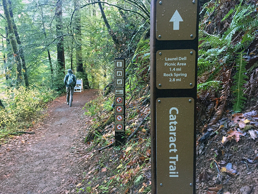
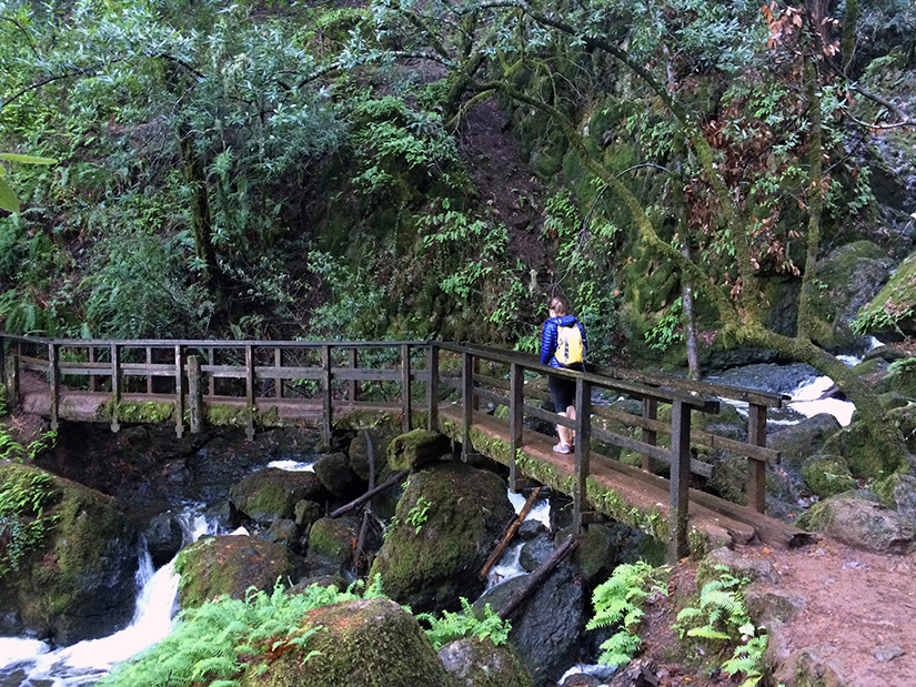
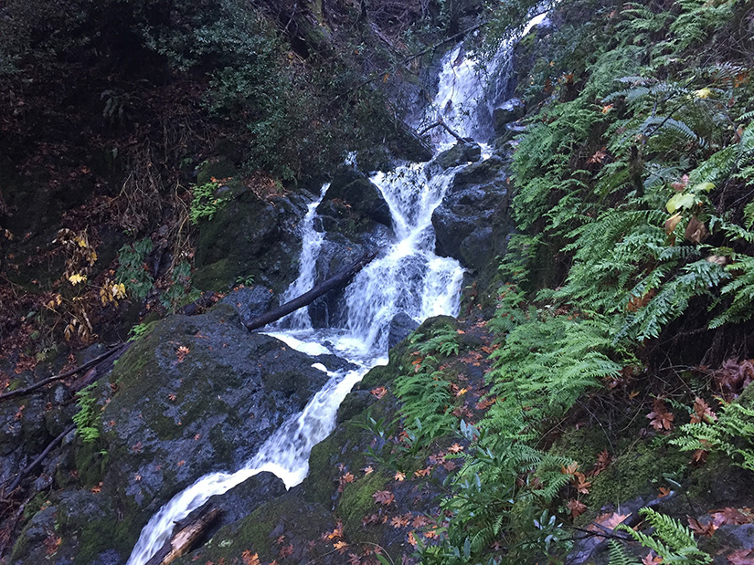
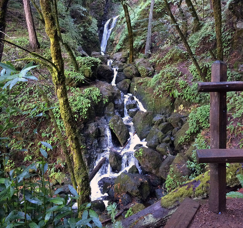
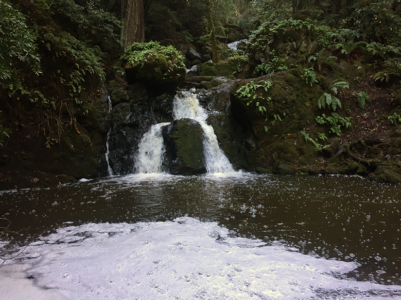
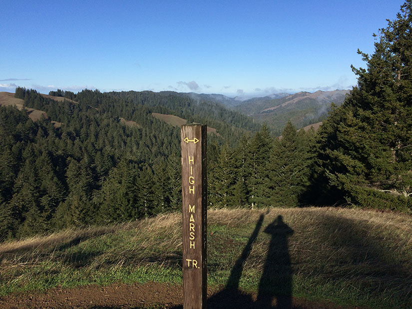
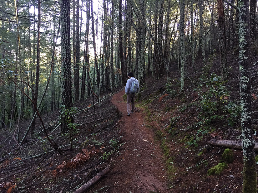
The trail contours a short distance around the shore of Alpine Lake, then almost immediately begins climbing up alongside Cataract Creek. This part of the hike is steep, but we were rewarded with one small waterfall after another. After 0.6 miles, we reached the junction with the Helen Markt trail (our return route). We continued onwards (past even more cascades) until we reached the High Marsh Trail junction (1.4 miles from the trailhead).
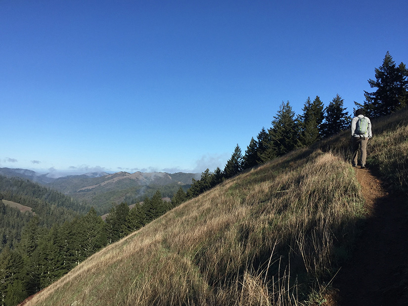
We took the left fork and parted ways with Cataract Creek, following the High Marsh Trail. We briefly emerged on to an open ridge before descending back down into the trees.
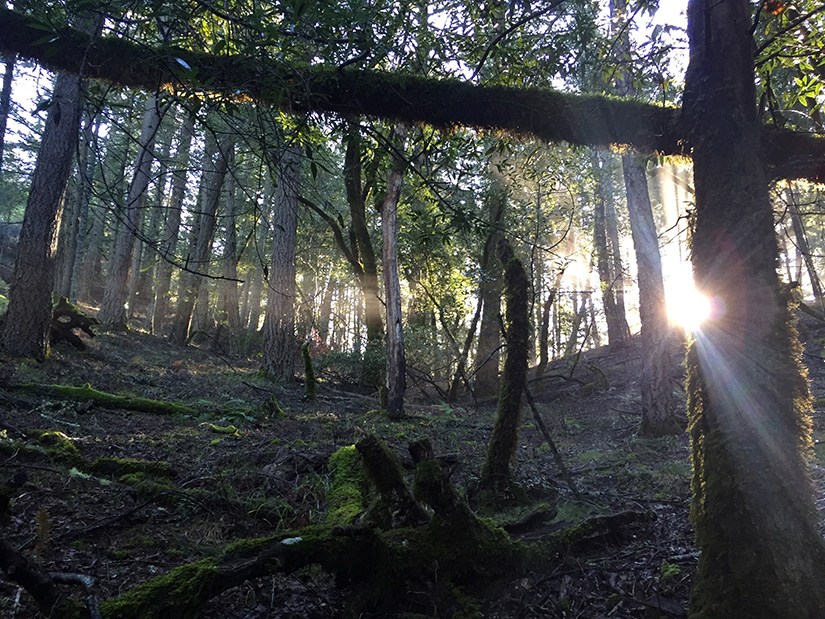
We stayed on the High Marsh Trail for 2 miles before reaching the Kent Trail. The Kent Trail was my favorite part of this hike. Our path followed a gentle slope down through the forest. The sun began poking through the trees. Best of all, we didn’t see a single person on this trail.
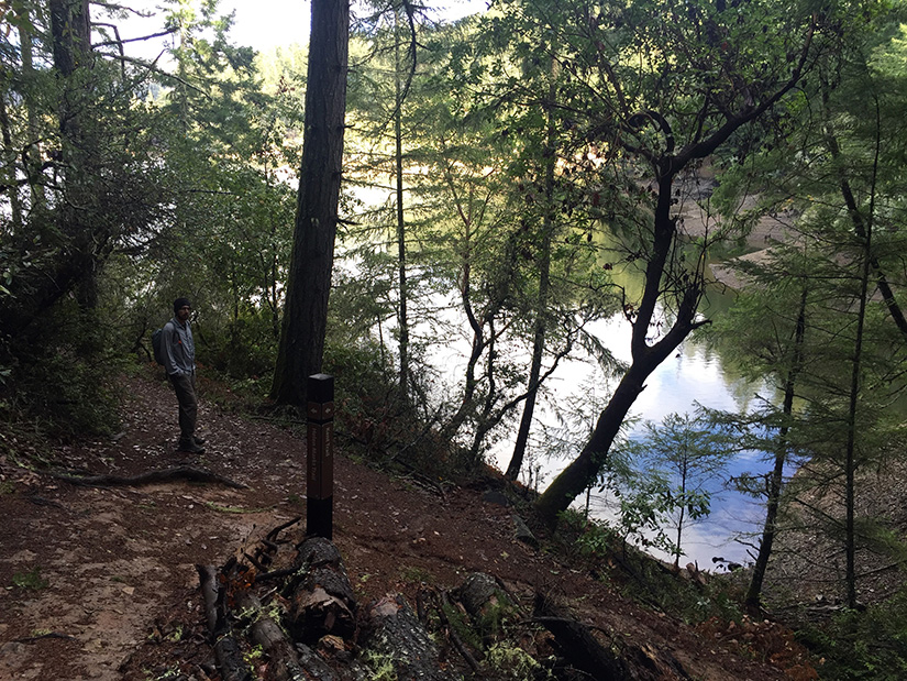
After 1.5 miles on the Kent Trail, we reached the Helen Markt junction. The Helen Markt Trail contours around the shores of Alpine Lake for 1.7 miles before returning to the Cataract Trail.
Rob and I both questioned why anyone would name a reservoir in Marin County “Alpine” Lake. It’s a lake, yes, but there’s a dam, no snow and no altitude. You’re not even allowed to swim in it. Basically the opposite of anything alpine. Nevertheless, the scenery around the lake was serene and enjoyable.
Our solitude ended upon returning to the Cataract Creek trail. By now it was mid-day so lots of people were out enjoying the falls. It was a short downhill walk back to the parking area which was now filled with cars.
More Info: This great map by Tom Harrison allowed us to plan the trip, and not get lost along the way:

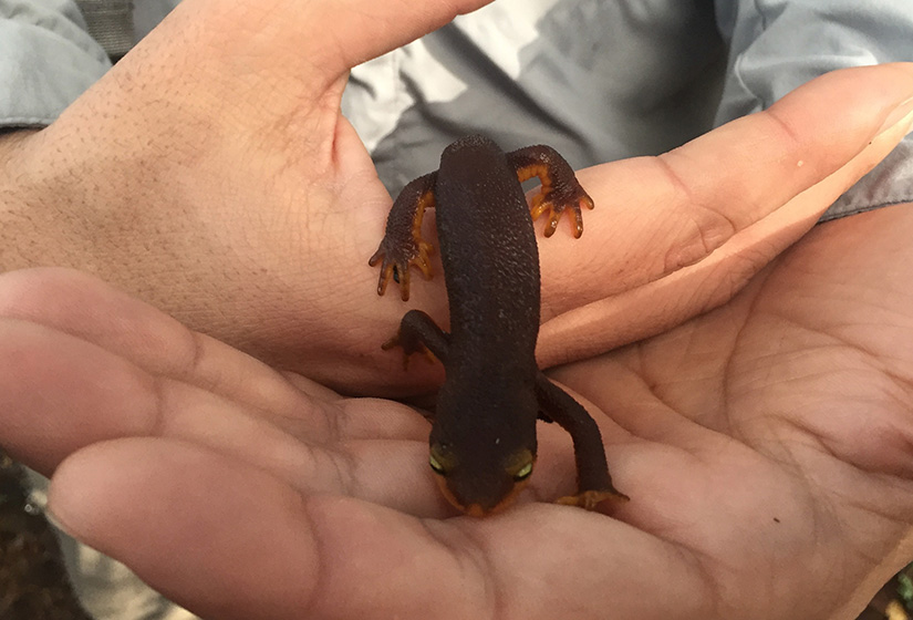
I went on this trail last Saturday. I’d like people to know that you should not touch the newts, since I think they are california newts which secrete a dangerous neurotoxin to protect themselves from predators [1]. I thought it was fine because of your post holding the newt, but later after looking up the species, it was lucky my friend didn’t experience more irritation from touching the newts.
https://www.inaturalist.org/taxa/27818-Taricha-torosa
Hi Jessica,
Thank you for the comment. Even a portion of the skin of a single newt, if ingested, can be fatal. It is very toxic to the body, but it’s not a severe skin irritant like poison oak. It is generally advised to wash your hands after in case you’re eating and sandwich or something. The reason newts are so easy to pick up compared to other critters, is that they’re so toxic to birds and mammals they don’t need to stay hidden or try hard to escape. They do arch their backs to slowly roll away and expose their bright belly as a warning to predators.
Also…if you do have to pick one up, please make sure your hands are wet so as not to injure the creature. Thank you.