Schulman Grove Loop – Ancient Bristlecone Pine Forest

00

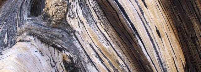
This 4 mile loop snakes through one of several bristlecone pine groves in the White Mountains of California.  The bristlecones are the oldest living trees (and the oldest living anything) on earth!  This trail is pretty far “out there,” but these trees are incredible and definitely worth a visit.  The hike itself is at 9,500 to 10,500-ft elevation and has several hundred feet of up and down.  There is a visitor center at the trailhead.  There is also an option for a shorter 1 mile loop with equally spectacular views of the ancient bristlecones. Continue reading “Schulman Grove Loop – Ancient Bristlecone Pine Forest”

Mount Williamson via Shepherd Pass

00

There is nothing easy about climbing California’s second tallest peak. The approach is long (over 26 miles round trip) and involves climbing nearly 10,000 ft. Some super humans have day hiked this peak. We took three days to do it and it was still quite a challenge. Continue reading “Mount Williamson via Shepherd Pass”

Round Top and Winnemucca Lake

00

Climbing to the top of Round Top is an interesting hike – it starts of very mellow/easy and gets progressively more difficult as you get closer to the summit. The final 100′ or so are considered an easy Class 3. This hike is located in the Carson Pass Management Area (part of the Mokelumne Wilderness), just south of Highway 88 near Kirkwood Mountain Resort. The beginning of the hike is crowded – many people simply hike up to Winnemucca Lake (a worthy destination in itself) – but far fewer people reach the summit of Round Top. When hiked as a loop, this trip is approximately 6.5 miles with 2000 ft of elevation gain. There are many trail signs; if one knows which general direction to head in, it’s nearly impossible to get lost.

Continue reading “Round Top and Winnemucca Lake”

Lake Aloha via the Ralston Peak Trail

00

Shortly after our last failed attempt at backpacking in Desolation Wilderness, I was ready to try again. We waited a few weeks for more snow to melt, then made our reservation for Lake Aloha (Zone 33). We snagged 6 of the allotted 25 spots for this zone.

Basics: This overnight hike was about 13 miles round-trip. This distance sounds easier than it is – the Ralston trail begins by climbing 2400-ft in a few short miles. Anyone looking for an easier approach can access Lake Aloha from the Echo Lakes area. From the route described in this post, it’s possible to take short detours to climb Ralston Peak or visit several other Desolation Wilderness lakes. Continue reading “Lake Aloha via the Ralston Peak Trail”

Lyons Creek Trail – Desolation Wilderness

00

Things don’t always go according to plan.  I’m normally pretty good at planning stuff and I have decent luck most of the time, but every once in a while hiking does not go how I expect.

Continue reading “Lyons Creek Trail – Desolation Wilderness”

Loch Leven Lakes

00

Basics: Loch Leven Lakes are three very popular alpine lakes in Tahoe National Forest.  The lakes are surrounded by granite and typical Sierra scenery.  The hike is approximately 8 miles roundtrip.  It is slightly shorter if your destination is the first of the three lakes.  These lakes offer great swimming and camping – they definitely get crowded on summer weekends! Continue reading “Loch Leven Lakes”

Black Butte

Black Butte is a hike up a small volcanic peak with great views of Mt. Shasta. It’s a little over 5 miles round trip and 1850 feet of elevation gain.

00

We drove up to Bend, Oregon last week to visit family and spend a few days skiing.  Not much snow in California this winter, so Mount Bachelor was worth the long trek!  On our drive up, we passed under the shadow of Black Butte – a prominent peak right next to I-5 in the Mount Shasta area.  It looks relatively small next to Mount Shasta, but it is actually 6334-ft and looms steeply above the freeway.  As we drove toward it, we both exclaimed: “What is that peak?  Can we climb it?!”  Turns out, there’s an easy trail that goes to the top. Continue reading “Black Butte”

Martis Peak Fire Lookout

The fire lookout on Martis Peak can be reached from both Martis Peak Road and the Tahoe Rim Trail. We had a limited amount of time, so we opted to go up the paved road which is a slightly shorter route. This hike is 8 miles roundtrip, with about 1700-ft of elevation gain.

00

It’s been way too long since we got out and hit the trails.  We had some spare time before the holidays, so we decided to head up to Tahoe for the weekend.  There’s not much snow yet this year – 2013 was the driest calendar year on record (though water is usually summed by water year: Oct-Sep).  California is going to have some serious water problems if we don’t get crazy amounts of rain/snow in the next couple of months.  We wanted to use our snowshoes, but the road looked pretty bare so we left them in the car.  (Of course the road was completely covered in snow as soon as we turned the first corner.)  This hike was 8 miles roundtrip, with about 1700-ft of elevation gain. Continue reading “Martis Peak Fire Lookout”

Ropi Lake via Horsetail Falls – Desolation Wilderness

This hike is 6-ish difficult miles beginning at the Pyramid Creek trailhead on Highway 50, with about 1900 feet of elevation gain. The unmaintained trail goes past Horsetail Falls (a neat destination itself) up to several beautiful lakes in Desolation Wilderness.

00

I’ve been wanting to hike up Pyramid Peak for quite some time, but it just hasn’t happened (yet). On the occasions I have planned to do this hike, I’ve been stopped by major thunderstorms or crazy gusts of wind. This weekend, the weather was looking pretty perfect, but with a late start and the days already getting shorter, we didn’t make it up the peak. I will get there eventually.  Instead, we hiked up to some high alpine lakes and enjoyed a beautiful and relaxing October day in Desolation Wilderness. Continue reading “Ropi Lake via Horsetail Falls – Desolation Wilderness”

Mount Tallac in Desolation Wilderness

00

Basics:  Mount Tallac is a 10 mile hike (out and back) with approximately 3500 ft of elevation gain.  The main trailhead is just a few miles west of South Lake Tahoe, though this peak can also be reached from Gilmore Lake and other areas deeper in Desolation Wilderness.  It’s strenuous, but the incredible views down to Fallen Leaf Lake, Lake Tahoe, and over to Desolation Wilderness make this a very popular hike.  On summer weekends, there can easily be dozens of people on the summit at once.  I would recommend an early start.  Permits for day hikes are self-issued at the trailhead.  For overnight trips, reserve your permit in advance at Recreation.gov. Continue reading “Mount Tallac in Desolation Wilderness”