
Climbing to the top of Round Top is an interesting hike – it starts of very mellow/easy and gets progressively more difficult as you get closer to the summit. The final 100′ or so are considered an easy Class 3. This hike is located in the Carson Pass Management Area (part of the Mokelumne Wilderness), just south of Highway 88 near Kirkwood Mountain Resort. The beginning of the hike is crowded – many people simply hike up to Winnemucca Lake (a worthy destination in itself) – but far fewer people reach the summit of Round Top. When hiked as a loop, this trip is approximately 6.5 miles with 2000 ft of elevation gain. There are many trail signs; if one knows which general direction to head in, it’s nearly impossible to get lost.
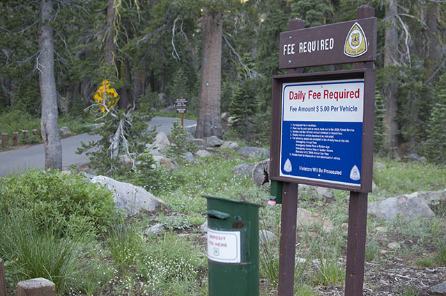
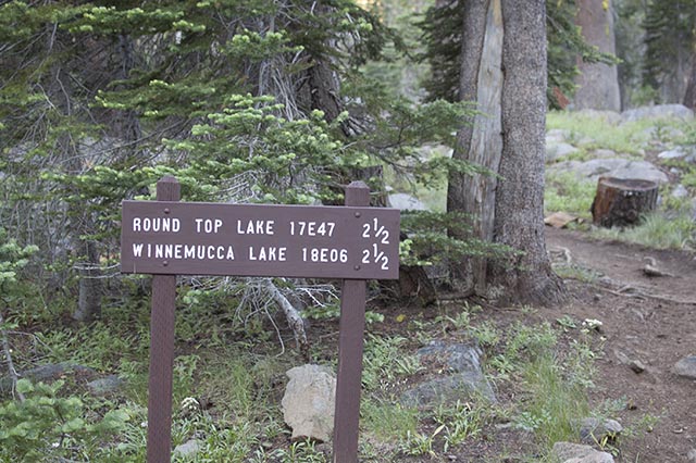
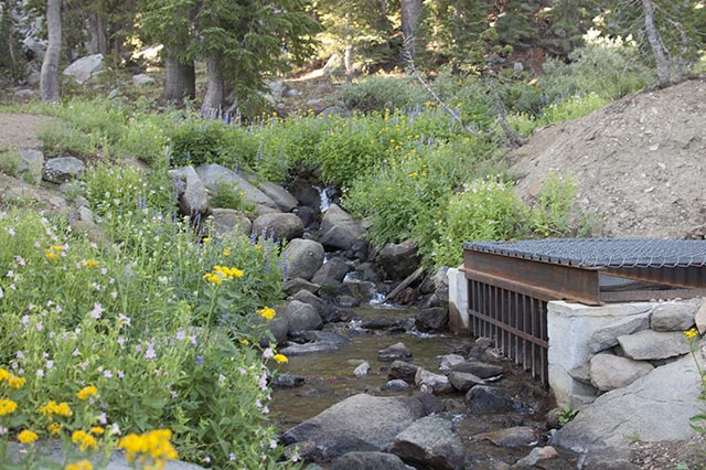
Trailheads & Red Tape: There are two main trailheads for this hike. The first option is to hike along the PCT from Carson Pass. (Follow signs for Winnemucca Lake.) We opted to hike from Woods Lake campground. There is a large trailhead parking lot with pit toilets near the campground – it’s just off of Highway 88 between Caples Lake and Carson Pass. There is a day use fee – it was $5 at the time we did this hike. Once you turn off Highway 88, the parking lot is well signed and difficult to miss. The actual trail begins a short distance further down the road, just after the bridge.
Trail Description: It seems that there has been nothing but daily thunderstorms in the Sierras for the past few weeks. From as far away as Sacramento we can see the massive clouds building up every afternoon. Despite this, we had our minds set on hiking Round Top. I figured, it’s a short hike; if we started early we’d be off the mountain before noon.
Friday night we stayed at Kirkwood Mountain Resort and enjoyed dinner at the historic Kirkwood Saloon & Inn. Built in 1864, the restaurant is a CA Historic Landmark and sits in a location where three county lines meet. In the days of Prohibition, the inn had a bar on wheels that they would move across the different county lines depending on which county’s law enforcement members were visiting.
Saturday morning we were up early to a gloriously cloudless sky. We drove the short distance to the Woods Lake trailhead and were hiking by 6:30 am.
We decided to hike in a counter-clockwise direction, so we began by heading towards Round Top Lake. Rob wore trail runners instead of his usual heavy boots. This made him walk much faster than I am used to! I felt the elevation, but luckily the trail wasn’t too steep and I managed to keep up. Eventually he ran out of breath and slowed down. After maybe a mile, we passed remnants of the Lost Cabin Mine.
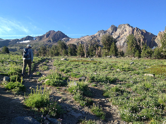
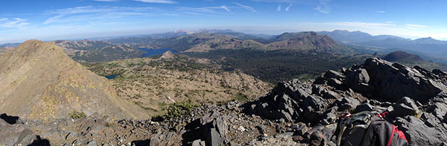
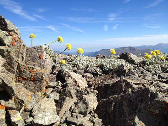
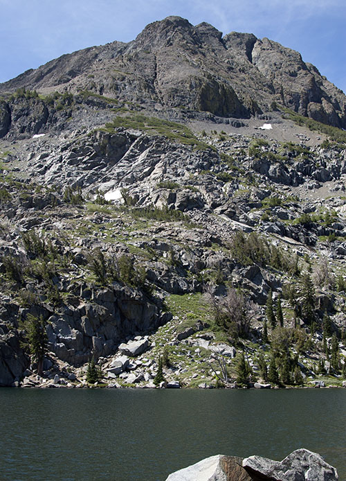
After just over two quick miles we reached Round Top Lake. The mountain towers above the lake and we could see a faint trail heading up the west side.
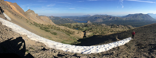
Tree line is just above the lake. The sky was still clear, so we up we went. This is a steeper part of the trail, but soon we were standing on the saddle between Round Top and The Sisters.
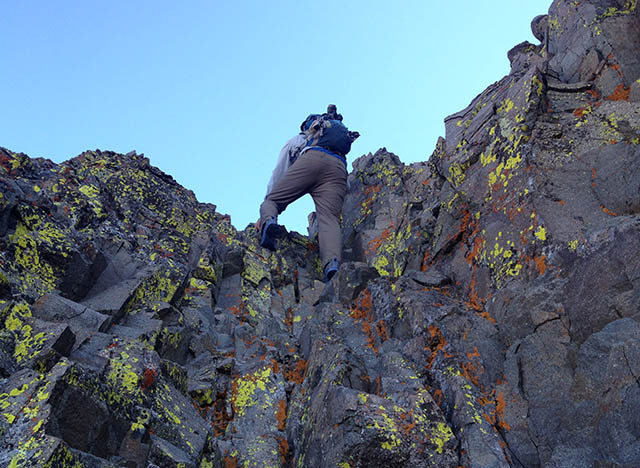
From the saddle, we turned left (east) and ascended over a mixture of loose gravel and solid rock.
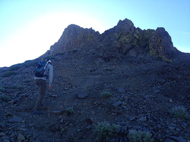
After a bit of climbing, we were standing at the top of the lower false summit. It had been easier than I expected! Little did we know the most challenging part was between here and the true summit.
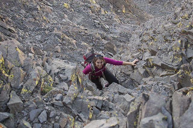
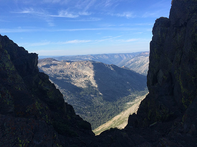
We picked our way across the ridge towards the high point. This involved crossing two large notches. We carefully climbed down and back up an easy Class 3 route. Shortly thereafter we were standing at the top! We had not seen any other hikers all day and we had the summit to ourselves.
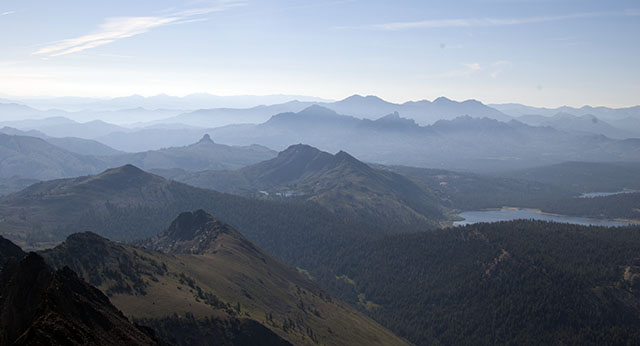
After taking in the views, we headed down. Soon we started seeing other people coming up the trail.
In order to make this a loop, we hiked east from Round Top Lake towards Winnemucca Lake. Winnemucca is beautiful- many hikers were scattered along the shore, taking in the views. We sat. I was tempted to swim, but chickened out and just stuck my feet in the water.
After a long break at the lake, we headed down the gently graded trail back to the Woods Lake TH. Lots of people were hiking up the path by this time. Baby thunderheads were forming in the distance, but the sun was still shining by the time we reached the car.
Congrats on a safe and successful summit. It’s been about 18X for me, and most hikers refuse to go to the true top. Any register still? The hiking club claims the peak, but they stop at the false summit, as with Castle Peak and others. Each to their own, but I like honest hikers and climbers, none of those left in the area!
Thanks Pete. There is still a register up at the top. Not very many signatures for how many people were out on the trails – maybe one every 5 days or so. You’re right – many people only hike to the false summit or even just to the saddle to the west of the peak.
Be assured that your effort and risk is not wasted. Most people seem to take the true summit as even lower, but I actually measured it using a level. Why the morons will never get rich by say a treasure hunt. They can’t determine a true location ever, even with government maps and now GPS and all. That recent news item about hidden money seems to reward the smart, not the stupid. Too bad the parks and also peaks have suffered from people looking in the wrong places!
Wow, this looks awesome! I really like the pictures of you guys climbing/scrambling. That moss/lichen is so green!
We need to do some of these scramble-y/climb-y trips together.
Thanks Andy! I know just the hike: Devils Peak (near Sugar Bowl)! Perhaps we can climb it when we’re up there in August.
it is indeed a great hike! i couldn’t tackle the true summit- we went up the right side and it was super dicey- only on the way down did we realize that the far left trail was the best route to the false summit.. .there was one intrepid hiker on the true summit and he tried to talk me through it, but my fear of heights got the better of me and i froze on the precarious ridge. the views from this point were spectacular, however and to me it was good enough. i’m not a risk taker and i know my limits. it’s a relatively easy hike/scramble to that point and i would absolutely recommend it. even with a healthy fear of heights you can make it to the quasi top. 🙂
Just retired at age 69…. Will be staying at Kit Carson lodge silver lake— will be nostalgic for me in that my childhood friend and I used to hike this area many times …. say 50 to 57 years ago… I remember the sense of accomplishment finding Monty Wolffs cabin…. At age 18 we did the Tahoe Yosemite trail…. It has been WAY to long since I have been “in the woods” …..looking forward to seeing this area again.