
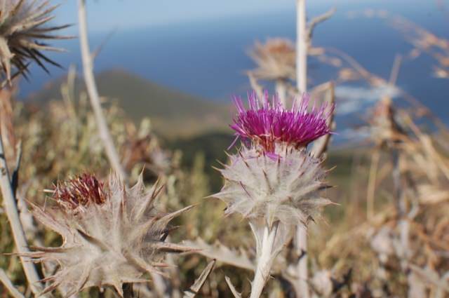
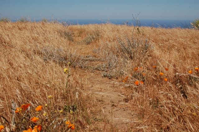
Basics: This 4+ mile loop trail in Garrapata SP goes from coastal chaparral to grassy hills with epic views to dense redwood forest. Parts of the trail are really steep, but the ocean views and springtime wildflowers are enough to keep anyone going. We added a side trip to Doud Peak, making this a 6 or 7 mile hike. Doud Peak was not worth the extra effort, but more on that later. This hike would be nice any time of year, but it’s especially pretty in the spring when the plants are still somewhat green and the wildflowers are blooming. It’s also a great workout if you are in the area and want to hike something that won’t take all day.
Directions to Trailhead: We followed the directions on Gurmeet’s blog. He links to GPS coordinates – quite useful when driving with the iPhone (or other nav device) in hand. The two main trailheads (for the Rocky Ridge Trail and the Soberanes Canyon Trail) each have large turnouts on the ocean side of Hwy 1. When coming from Carmel, the first turnout is approximately 5.2 miles south of Monastary Beach (the wide sandy cove/beach right off of Hwy 1). The second parking area is less than a quarter mile further. Both trailheads provide access to the loop described below.
[map kml=”http://www.norcalhiker.com/maps/Garrapata.kml” download=”no” elevation=”yes” style=”width:100%; height:400px” /]Note: GPS based distance is approximate. Download gpx of this route. Download kml of this route.
Trail Description: We spent the first weekend of June in Monterey for a wedding. But while there, why not fit in some hiking? Woke up early in one of the super fancy hotels on Cannery Row, stopped at Trader Joe’s for muffins and a gallon of water, then made the 20 minute drive to the trailhead.

It was a beautiful sunny day – no fog! We started up the Rocky Ridge Trail, directly across from the parking area on Highway 1. We hiked this loop in a clockwise direction. Almost immediately we got to a junction. Are you kidding? We’re lost and/or confused after less than a quarter mile? I obviously hadn’t studied any trail maps. We headed to the left because it appeared to go uphill. Soon, a well traveled path split off to our right and clearly climbed up away from the ocean and the highway.
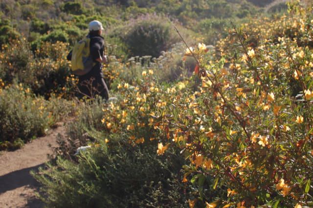
We climbed up the first hill. This gave way to a bigger hill. Then more uphill hiking after that. Rob called this “the hike of a thousand false peaks.” It really wasn’t that bad. Wildflowers were blooming and we had sweeping ocean views. Somewhere around the 2 mile mark, we came across a nice vista point with a bench. We sat for a little while, but there were huge bumblebees buzzing around our heads, so we hurried back on to the trail.

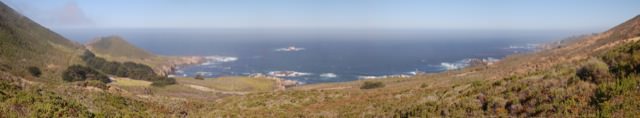
We climbed one last hill and made it up to a wide open ridge. From here, the views were really nice. The ridge was mostly grass and wildflowers, but there were several rocky outcroppings that provided good seating. This must be Rocky Ridge. We continued onwards, down off the ridge towards a junction with the Peak Trail.

We turned left and headed up the peak trail. It basically went nowhere. The trail got really narrow, overgrown (long grasses with ticks!) and eventually just kind of ended on what maybe was a high spot amongst all the other grassy hills. We checked the GPS, and we were indeed standing on Doud Peak. The views back on Rocky Ridge were better.
We backtracked to the junction, turned left and began the descent towards the redwoods. This part of the trail was really steep. It was difficult going down, but I was glad that we were not one of the people climbing up in the warm mid-day sun. On any other day I might be up for this challenge, but I was glad that we hiked the loop in a clockwise direction. The path we took up was much less steep.
After a long descent, we made it to the Soberanes Canyon Trail. From here, the trail followed a creek through the shady redwood forest. It was a drastic and welcome contrast to the rest of the hike.
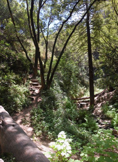
Eventually, the trail broke through the trees. We were still following the creek through the canyon, so the path stayed relatively flat.
Before reaching Highway 1, the Rocky Ridge Trail split off to our right. This took us back to the turnout where we were parked. Overall, beautiful hike in a beautiful part of California. We definitely enjoyed our first visit to this State Park.