Basics: The Dipsea Trail is a 7 mile trail running from Mill Valley through Muir Woods and Mt Tamalpais State Park all the way to Stinson Beach. It is home to one of the oldest trail races in the country – the Dipsea Race – first run in 1905. With two cars (or a willingness to research bus schedules), the trail can be hiked one way. If transportation options are limited, it’s possible to hike the entire trail out and back for a total of 14 miles and 4400-ft of elevation gain.
[map kml=”http://www.norcalhiker.com/maps/Double_Dipsea.kml” download=”no” elevation=”yes” style=”width:100%; height:400px” /]Note: GPS based distance is approximate. Download gpx of this route. Download kml of this route.
Directions to Trailhead: We spent a bit of time trying to figure out where to start walking – I wish I had researched this a little more. Park at Old Mill Park in Mill Valley. We found parking on Elma Street next to the school. I also noticed a lot of cars were parked on Molino Ave near the intersection with Cascade Dr. Once parked, walk up Cascade Way – a narrow road that looks like a driveway. Cascade Way dead-ends at the first set of stairs.

Trail Description: Despite the Friday morning commuter traffic (plus a car accident that had been cleared to the right shoulder) we got to the trailhead early. We parked near Old Mill Park and started wandering around trying to find the trailhead. The Dipsea Trail begins by climbing through the redwoods, up three very long sets of stairs. This totals something like a 50-story building. We failed at finding the first set of stairs. The key is to walk up Cascade Way – it leads you to the correct spot. Instead, we found stairs just east of the small dirt parking area on Molino Ave. At the top of this set, we wandered around for a little while before we eventually made it onto the official trail. The second flight of stairs climbs from Marion Ave up to Hazel Ave. On Hazel, turn left to reach the third flight of stairs. At the top of the third flight of stairs, the trail continues to the right, across a crosswalk and alongside Sequoia Valley Road. It then veers right on Walsh Dr. When the road dead-ends, the trail continues, eventually leading to Bay View Dr. Walk past the fancy houses and eventually you reach the Panoramic Hwy. After running across the road, the trail continues on your right. From this point on, the trail is reasonably well signed. It’s still useful to have a map – or some idea of where you are going.

We followed the trail down to a parking lot at Muir Woods. It was a Friday and still relatively early, so there were few cars – it would be packed later in the day when we passed back through. We continued on the trail from the parking lot, staying in the woods for quite a while. Eventually we reached Cardiac Hill and soon after we were at the high point of the trail, near the border between Muir Woods National Monument and Mt Tam State Park. From here, the forest gave way to rolling grassy hills. We could see the Bay Bridge, the top of the SF skyline and the tops of the Golden Gate towers.


Soon the nicely graded, flattish trail started heading downwards toward the ocean. We were back in the forest. Eventually the trail became so steep that it once again turned into stair steps. These were definitely more primitive stairs than what was on the Mill Valley side. I really enjoyed this part of the hike, though I wondered how difficult it would be to climb back up all of it. We were soon close to sea level. The trail once again flattens out as it nears Stinson Beach. We walked through the chaparral and before we knew it, we reached the coast! Stinson Beach has a large picnic area. We ate some snacks and walked down to the water. Rob tested out how waterproof his new hiking boots are. Lucky for him they are totally waterproof – that could have been an unpleasant 7 mile hike back to the car… We then turned around and retraced our steps back to Mill Valley. There were a lot more people out on the trail on our way back. I guess when it’s 70 degrees and sunny in January, a lot of people go out and hike, even on a weekday.

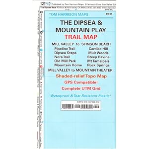
More info: This hike has been done by I.N.C.H. several times. This lovely map by Tom Harrison may be helpful if you plan to hike in the area: